Most of us understand that if we cycle or walk over paths where toadlets are migrating, that hurts them.
We can see that it is hard for them to hop across the trail when there are obstructions.
Sadly, sometimes we can see our impact when they are stuck to our bike tires or the bottom of our sneakers.
But humans are doing this to animals on a much grander scale.
The destruction of habitat or its fragmentation — creating patches of wildland that aren’t connected — leaves wildlife playing Frogger across roads to get to food, water or mating sources, for example.
Habitat loss is the leading cause of biodiversity loss worldwide, environmentalists say.
According to the Encyclopedia of Biodiversity, the "conversion of habitat by humans into other land uses can fragment and separate mammal populations and increase the likelihood of local population extinctions and eventual species extinction."
With so many people moving to and visiting the Sea to Sky Corridor, development and human pressure are at an all-time high.
But growth doesn't have to happen at the cost of our wildlife, local environmentalists say.
Dedicated Sea to Sky volunteers are working on a years-long project to ultimately improve wildlife connectivity in Squamish and beyond.
The Wildlife Connectivity project is a collaboration between the Squamish Environment Society (SES) and the Átl’ka7tsem/Howe Sound Biosphere Region Initiative to help identify areas that could be protected as habitat connectivity corridors.
Sḵwx̱wú7mesh Úxwumixw (Squamish Nation) is also a partner in the project.
Rachel Munger, the Nation’s environmental manager, participates in this project's steering committee.
What is happening on the ground?
A habitat connectivity corridor — sometimes also called an ecological corridor, ecosystem corridor, wildlife corridor or movement corridor — is a network of land that links habitats together, according to wildlife specialist Meg Toom, who is also involved in the project.
Linking habitat or connecting patches of land helps to connect wildlife and habitat that would otherwise be separated by roads, cultivated land and other human forms of development.
It helps animals move around to get what they need to thrive, in other words.
As part of the project, landscape modelling will identify suitable areas of already protected lands, relatively undisturbed ecosystems, and potential restoration sites.
The volunteers involved note that the areas of land don't have to be massive swaths.
They could be areas of rivers, creeks, riparian links, and crossings over or under roads.
The volunteers said protecting the environment now is vital.
"Timing is right. We're all trying to move in the same direction towards ... doing a better job of protecting the environment,” said Ruth Simons, lead of the Átl’ka7tsem/Howe Sound Biosphere Region Initiative.
Timeline
In summer 2021, the Squamish Environment Society commissioned CoastRange Environmental Ltd. to begin this work by conducting preliminary scoping. This led to the Phase 1 – Squamish Habitat Connectivity report that lays out three more phases.
Karlene Loudon from CoastRange is the lead for both Phase 1 and Phase 2.
This is still in the first full year of the project.
Year two will include creating a conservation strategy and modelling.
"Come up with some maps and some models of existing corridors and areas that would be suitable for corridors before all the development takes place, stops the possibilities,” said Gwen L'Hirondelle, of the SES. “And then somehow come up with a way in the development permit world to ensure that when development happens, it allows for some natural movement.”
Also, this year, among other steps, thorough stakeholder consultation will continue, and corridors will be mapped.
Policy and implementation will take place in year three.
Thereafter, the success of what is created will be monitored and adapted as needed.
Protecting wildlife is something that is widely supported in the corridor, said citizen scientist Judith Holm, of the SES.
And it is a project that is just in the nick of time.
"Right now, there's all this land around where the people are being contained, but that won't last forever,” she said. “And so if we can get a really solid plan, and we can get a whole network of different types of lands that are connected before there are shopping centres in the way, houses in the way, it'll be much less expensive.”
“It'll be much better for the animals, and it's an all-win situation."
Asked if it was not too late for Squamish the volunteers said no.
There is still much land-use planning in our community that has yet to be completed, they said.
Working together
The Howe Sound Biosphere Region Initiative, led by Simons, is responsible for managing the Biosphere Region. The organization found that the objectives of the Biosphere Region mesh well with wildlife connectivity, thus, the two organizations fit well together to collaborate.
The Howe Sound region achieved the designation of Átl'ka7tsem/Sound UNESCO Biosphere Region on Sept. 15, 2021.
"It's a project that really needs to be sustained,” said Simons, referring to the Wildlife Connectivity project.
“And that is going to take a lot of effort to see it through all phases and funding … it costs money to do all this work. So, the Biosphere is totally supportive of it. This totally fits in with what the biosphere is aiming to achieve. As well, as it really fits well, now with Canada's Nature Legacy and objectives for Canada's biodiversity targets," she added.
The federal government has pledged to protect 25% of the nation's lands and oceans by 2025, increasing to 30% by 2030.
“This is our way of contributing towards that. And also, our role is to be able to bring that capacity to this project to see it through. And then it's a model for the whole region," said Simons, who lives in Lions Bay.
The volunteers The Squamish Chief spoke to noted that this project could become an example for other areas.
The work of the project aims to support the District of Squamish — and other decision-makers — in making land use decisions.
With more habitat connectivity information, the powers-that-be in the District make better use of the development permit tools at their disposal, for example.
This work will guide the District to make effective progress in creating wildlife connectivity, in other words.
Protecting wildlife and creating ecosystem connectivity is complex and crosses many jurisdictions. Thus many stakeholders will be involved, including federal, provincial, regional and municipal governments, First Nations, private landowners, community members and organizations, and experts, the volunteers say.
Simons stressed that this isn't about being adversarial to government or development. Rather, it is finding a way to all work together toward a common goal that is a win for all.
"We're trying to balance the growth of people and the reality that more people are coming and how we're developing but doing it in a more wise, more informed way so that all life can thrive in this area — where humanity and nature thrive."
District of Squamish supportive
Lesley Douglas, the District’s senior environmental specialist, told The Squamish Chief that the District is fully supportive of the project, penning a letter of support in January.
“Wildlife habitat connectivity is an important factor in development and conservation decisions at the District. This project offers an opportunity to work at a broader landscape scale in the Sea to Sky area and build capacity and collaboration amongst First Nations, regional, provincial and federal governments and community groups,” Douglas said in an emailed statement.
“This work is especially important as the region continues to experience strong growth and visitation pressure. The District has committed to participate in a multi-jurisdictional working group to support the project once it is funded, and the outcomes will be of great utility in future municipal decisions.
Local and regional habitat data and knowledge collection, mapping and subsequent recommendations identified as key deliverables for this project will help to inform ongoing planning and specific land use policies and strategies within the municipality.”
Why this matters
Toom explains that when people build and encroach on natural areas, it can threaten ecosystem biodiversity and core habitat.
It also threatens the culture and values of the Sḵwx̱wú7mesh Úxwumixw.
"Encroachment causes fragmentation leaving habitat patches isolated, hindering wildlife's ability to move through the landscape, thereby reducing genetic diversity and impacting overall species survival," Toom said.
"Climate change impacts the natural environment. It forces wildlife species to migrate
in search of new habitat and home ranges. Forest fires and natural food availability shortages create the need for ecosystem connectivity — networks that allow wildlife to move through the landscape as they adapt to a changing environment."
Helping the animals also helps people by protecting systems that we rely on for water, food and air.
Scientist Murray Journeay, of the SES, explains the project in terms of our collective resilience.
"Trying to make our natural habitats more resilient to the change that's happening, and the changes that will be happening in the near future that we can see and imagine. But also, moving forward looking at the impacts of climate change, not only are we going to be, trying to adapt to those pressures, but so will those [animals] in wild habitat," said Journeay.
Asked how researchers figure out where the corridors are or should be, Journeay said Indigenous knowledge and science combine to give answers to that question.
"There actually was quite a lot of information and knowledge, both traditional Indigenous knowledge about the land and how it has been occupied both by animals but also by people and the impact that we've had over centuries. There's that base knowledge. And then there's scientific knowledge that's been gathered about specific habitat and how it's used."
The project also builds on a long list of work already done and decision-making documents that support conserving biodiversity and protecting wildlife populations.
“Work with local governments to develop effective, tangible and prescriptive policy to ensure appropriate use and protection of corridors,” reads the SES website on the project.
SLRD supportive of project
The Wildlife Connectivity project received a $20,000 grant from the Squamish Lillooet Regional District.
SLRD Area D director Tony Rainbow told The Squamish Chief that the UNESCO Biosphere designation isn’t a static award. To keep it, work in the area needs to be continuous.
The Wildlife Corridor project fits into that work, he said.
“If you look at connectivity issues in other parts of North America, the U.S. or Canada, it manifests itself in a number of ways,” he said.
“It could be when development is occurring, the recognition that this particular development is going to separate some habitat and that might affect the animals and use that area … even if they're not resident there. If it's an area that they pass through, if you cut it off, and they can no longer pass through there, then it can have a bad effect on their population and can create unnecessary conflicts between wildlife in humans. So it will be useful, I think, to come up with some mapping, showing areas that are known [habitat].
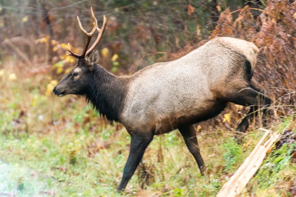
Rainbow pointed to black bears and how they move around the corridor as an example of an animal that this research project could help.
“They move from the sea level to higher elevations. And they need to be able to do that. If they can't do that, they end up spending more time hanging around people and houses and so on. And that causes problems. So it may be that when development was being considered that a certain section of forest would remain untouched to create a kind of wildlife corridor. It should inform our planners moving forward and give our developers information.”
There is also an economic benefit to creating safety for animals to move to where they need to be in that it costs money when animals are hit by cars on the road, for example, or destroy property because their movement has been impeded.
Rainbow echoed others on the project in saying that this isn’t a way to block development.
“It is just that when we do [develop], this is one more piece of the puzzle we should consider.”
How can locals help
Beyond pro-active actions such as planting native gardens and leaving no trace when recreating in the corridor, Simons says joining bird counts, and bio-blitzes also helps.
People don’t protect what they don’t feel connected to, the volunteers note. Downloading and using apps like Seek, which identifies plants and animals, and iNaturalist, which records your observations to share with fellow naturalists, also helps us connect to all that is around us.
And educating others on the importance of the natural world goes a long way.
The project can always use donations, too.
Find out how to donate on the Squamish Environment Society website.
Find out more about the project at www.squamishenvironment.ca/projects/habitat-connectivity.


