British Columbia is a land of extremes — known for its towering mountains, lush temperature rainforests and rocky coastlines, it also boasts Canada’s only desert.
So perhaps it’s not surprising that a single year can offer a thundering display of what mother nature is capable of. Add a splash of human hubris (and sometimes a slight delay to figure out what happened), and that list gets longer.
Here are five natural events Glacier Media reported on this year that stand out.
'Most extreme' rogue wave ever recorded

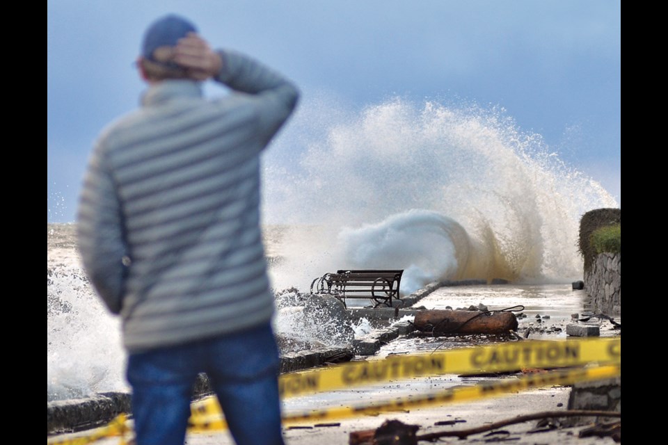
“Once in a millennium” is how scientists described the 17.6-metre mega wave recorded seven kilometres off Ucluelet, B.C. Picture a swell so tall its crest would dash on top of a four-storey building.
Triple the size of surrounding waves, the swell is thought to be the most extreme rogue wave ever recorded, and likely to occur only once every 1,300 years.
When sensor buoys captured its passing near Amphitrite Bank on Nov. 17, 2020, there were no ships around, according to a study published in February.
“Only a few rogue waves in high sea states have been observed directly, and nothing of this magnitude,” said University of Victoria researcher Johannes Gemmrich.
Mountain tsunami wipes out entire watershed
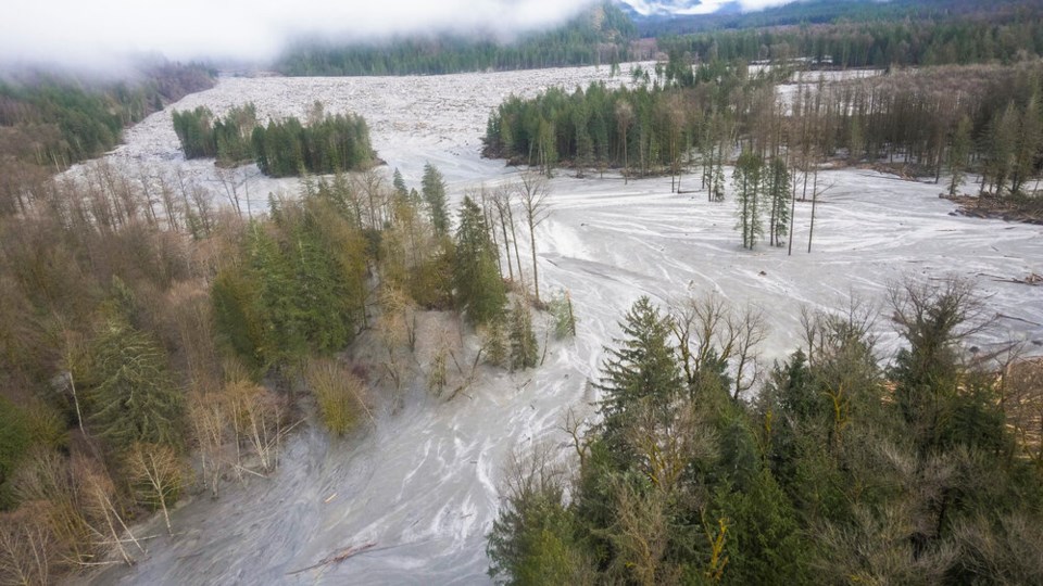
The evidence was sketchy at first: a magnitude five tremor picked up by a scientist in New York City, a helicopter pilot capturing video of a massive flood tearing up the the valley below.
At the mouth of Bute Inlet, the cousin of Homalco First Nation chief Darren Blaney would watch as rafts of busted-up timber nearly 200 metres long and 100 metres wide floated into the sea, plugging up the whole bay.
By February 2022, more than two years later, B.C. geomorphologist Marten Geertsema had finally pieced together what happened: in one catastrophic moment, alpine slopes once held together by ice failed, triggering a landslide roughly equal to the combined mass of all Canadian automobiles.
When all that rock slammed into the mountain lake below, it triggered a tremor and sent up a 100-metre wall of water into the air.
The initial wave rolled across the lake and burst through a glacier-deposited dam at the far end. The torrent of water would annihilate 8.5 kilometres of salmon-spawning habitat, scour the channel floor 40 metres deeper and send floodwaters and sediment 60 kilometres down the Southgate River.
Since 1900, at least 12,500 lives have been lost in such events around the world, and the phenomenon appears to becoming more common.
No human was hurt in the glacier outburst, but Geertsema and his colleagues said they worry melting glaciers retreating in the face of climate change could threaten lives in the future.
How climate change warped B.C.'s weather during a record fall drought
On B.C.’s south coast, a sunny September might be welcomed as an extended summer, but a dry October? Rainforest dwellers will know that’s nearly unheard of.
By the third week of October, the lack of rainfall had led to drought conditions in dozens of communities. Residents of the Sunshine Coast would remain in Stage 4 watering restrictions until December.
Vancouver and Kelowna reported just over half their normal precipitation during the first three months of fall. In places like Campbell River and Comox, seasonal rainfall dropped to a third of what it is in a normal year.
Also different this year: our ability to understand how climate change is making things worse.
The hot weather dominating much of British Columbia this fall was made roughly twice as likely due to climate change. In some places in the province, the chance climate change made temperatures hotter grew five times more likely, according to the Climate Shift Index, a new rapid attribution tool showing the real-time fingerprints of climate change.
“Credible” is the way Nathan Gillett, a research scientist at the Canadian Centre for Climate Modelling and Analysis, described it.
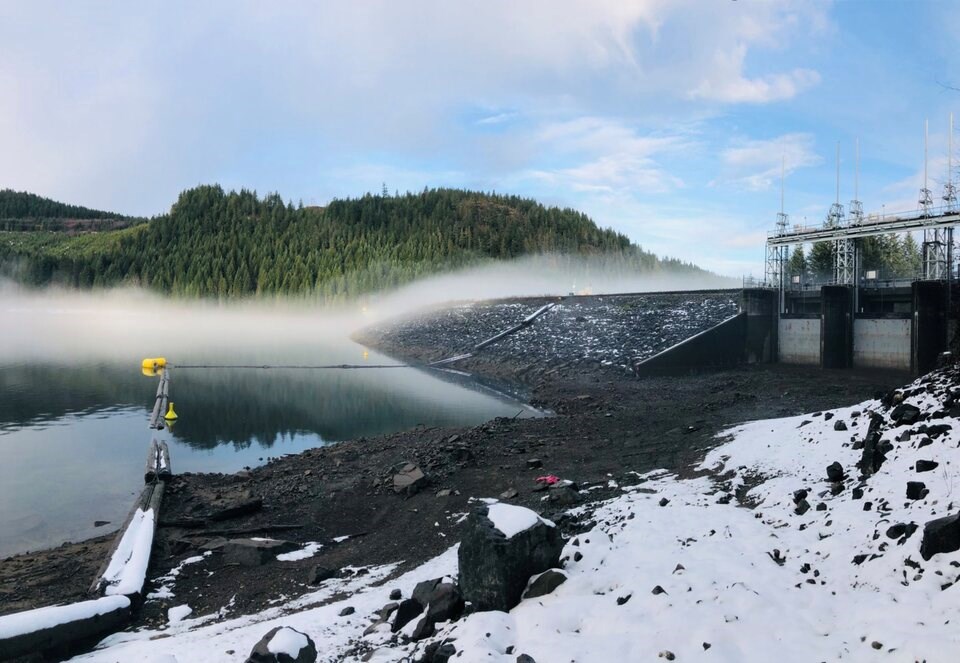
By the second week of December, some rain had fallen but not nearly enough to close the precipitation deficit. At BC Hydro’s dam in the Campbell River watershed, fall rainfall totals had dropped to their lowest levels on record, while the amount of water flowing into the reservoir dropped below a third of normal levels, the lowest in more than half a century. .
“This is a fall season we’ve never seen before,” said BC Hydro’s Stephen Watson. “It’s a very odd scenario.”
What the frack was that?
The first rumbles shook the wilderness about 130 kilometres northwest of Fort St. John, B.C.
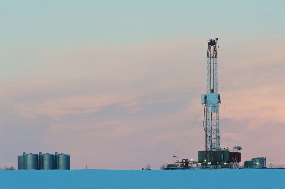
A magnitude 4.7 earthquake, enough to send a Petronas crew fracking for gas into an emergency shutdown, initially registered on the Canadian National Seismograph Network.
In the coming weeks, seismographs would pick up two more earthquakes — all nearly the exact same location and depth of a hydraulic fracking operation.
What are the odds the earthquakes were human-induced? “Very likely,” said Honn Kao, seismologist with the Geologic Survey of Canada who heads the federal government's Induced Seismicity Research Project.
Could the region be a “loaded bullet” waiting to go off? Kao and his team are still looking into it.
What is clear is that human-triggered earthquakes, while not new, are increasingly more common as we probe subterranean formations — especially those near fault lines.
One 2017 study that reviewed 730 anthropogenic projects thought to have induced earthquakes found mining was the most common seismic trigger, often due to collapsed material setting off shaking.
The most powerful human-triggered earthquake is thought to be the 2008 Great Sichuan earthquake in China, which at magnitude 7.9, killed nearly 90,000 people. Scientists believe the earthquake's origins go back to 2015, when the Zipingpu Reservoir impounded 320 million tonnes of water. The water’s weight is thought to have pushed down on the Longmen Shan fault line, hastening the earthquake’s arrival by up to hundreds of years.
Water has been shown to set off earthquakes when forced underground as well.
In Switzerland, a magnitude 3.4 earthquake was triggered in Basel when water was injected underground into a geothermal energy project. The 2006 event was followed by more than 200 earthquakes before the project was terminated in 2009.
The first documented case of human-caused earthquakes dates back to the 1960s, when a deep well was drilled into a mountain northeast of Denver to dispose of contaminated waste water. By the end of the decade, more than 700 earthquakes had been recorded in the region, most with an epicentre within eight kilometres of the well.
Then came the hydraulic fracturing industry, which in recent decades has brought vast wealth to oil and gas companies across the U.S. and Canada.
Also known as fracking, the extraction technique blasts pressurized liquid underground to fracture bedrock formations laced with hydrocarbons. Particles like sand hold open the cracks, allowing natural gas and petroleum to pass through to the surface where it can be collected, processed and burned.
But the footprint of such extraction processes is not just felt through the planet’s shifting climate. Underground, the injected fluid raises the pressure in the cracks, fissures and the pores between sand and rock. Over years of extraction, that pressure can build across kilometres of underground formations, eventually coming into contact and lubricating a seismic fault.
“You make the fault easier to slip,” Kao said.
Tonga volcanic eruption
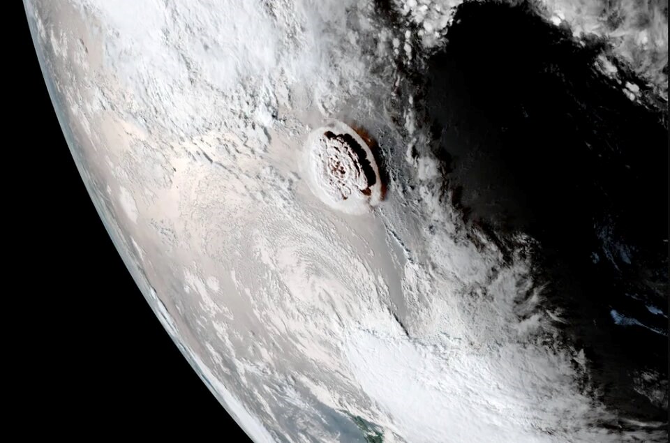
OK, this one didn’t happen in B.C., but in was one of the largest volcanic events ever recorded. The Jan. 15 undersea eruption of the Hunga Tonga-Hunga Ha’apai volcano triggered tsunami warnings around the Pacific Rim, including Vancouver Island and Juan de Fuca Strait.
The atmospheric explosion, which was heard 10,000 kilometres away in Alaska, is thought to be the biggest bang recorded by modern instruments, far bigger than any nuclear explosion.
The exploding seamount also triggered the highest concentration of lightning storms ever documented — at least 400,000 lightning strikes around the volcano — and launched water vapour so high it touched space, according to scientists speaking at a American Geophysical Union fall meeting in Chicago nearly a year later.
Other scientists at the meeting described a “magma hammer” slamming molten rock into the base of the underwater mountain — each with the force of a billion tonnes.
The eruption is a reminder for all along the Pacific Rim’s Ring of Fire, that earthquakes and volcanoes — while working on a different time scale — are a distinct possibility.
B.C.-based seismologist Melanie Kelman said it was also a reminder that more than one natural disaster can happen at the same time (the eruption and the COVID-19 pandemic) and that volcanoes can cause tsunamis too.
“Fortunately for B.C., the tsunami here was very small and not destructive. However, there are many submarine or coastal volcanoes around the Pacific Ring of Fire,” Kelman said. “So we should remember that even very distant volcanoes may cause tsunamis on our coast.”
If you were to count up all the recent eruptions in B.C. and the Yukon, Kelman says eruptions occur about once every 200 years.
But that’s just a long-term average and Kelman says we don’t know when the next eruption will be. She notes Canada could also be directly affected by volcanic ash from eruptions in Alaska or in the continental United States.
As far as scientist’s know, if B.C.’s volcanoes become restless, there will be warning signs. Those include emission of volcanic gases or a swarm of tremors as magma fights its way to the surface, Kelman said.
“These warning signs can help us to forecast the probability of an eruption occurring soon, although it is not possible to predict the exact time and size of an eruption,” she said.
