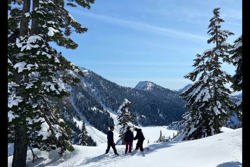
As the climate warms, Metro Vancouver residents should be aware of how snowpack levels affect our water supply and the importance of conservation efforts, say experts who monitor related data.
Snowpack levels vary greatly year to year, but the trend over the past 50 years is clearly downward. In terms of the 10-year running average, there’s been almost a 50-per-cent decrease in snow water equivalent (SWE) at Palisade Lake since May 1, 1976, according to Metro data. That site is around four kilometres north of Norvan Falls in Lynn Headwaters Regional Park, at close to 900 metres elevation.
At another monitoring site just west of the ski hill at Grouse Mountain, there’s been a 36-per-cent drop in SWE over the same period. That site is located at around 1,100 metres.
Over the past 10 years alone, SWE has fallen 30 per cent and 22 per cent at the two sites, respectively.
Since 1936, when measurements started at the Grouse monitoring site, peak snowpack was reached in the late 1970s, said Peter Marshall, a field hydrologist with Metro Vancouver regional district.
What’s caused the downward trend since then?
“For our area in particular, we’re really sensitive to changes in temperature,” he explained. “The North Shore mountains and our watershed areas where snowpack collects are relatively low elevation, and obviously very coastal. So an average winter temperature that degree or even two degrees from normal … is going to have a huge impact.”

Some of the major factors that affect snowpack are large climate drivers. One of them is El Niño, a climate pattern associated with warmer ocean temperatures that develop in the Equatorial Pacific. La Niña is the cold phase of that weather pattern. That pattern typically shifts every one to three years.
“For the last three years, we’ve had La Niña seasons, which have generally resulted in near to above normal snowpack,” Marshall said. “We’re shifting now into probably a fairly strong El Niño, which is concerning.”
Another trend could compound warming in the coming years. It’s called the Pacific Decadal Oscillation, which is considered to be a longer-lived, El Niño-like pattern. The PDO shifts every 20 to 30 years, Marshall said.
“When we’re in a cooler phase of the Pacific Decadal Oscillation, we see quite a bit more snow and in a warm phase – which occurred last in the 1980s and ’90s, we see a pretty significant decline in snowpack,” he said, adding that we’ve been in a cool phase for around 25 years now.
“It’s likely we’ll see a shift to warm face soon within the next few years. And when that happens it’s certainly another factor that might decrease snowpack,” Marshall continued.
How will falling snowpack levels affect local drinking water?
It’s important for residents to know that snowpack is an important part of our water supply, according to the Metro Vancouver hydrologist.
In a typical year, rain in the fall and through the winter replenish reservoirs from the previous summer. Then, when snowmelt happens from April to July, it keeps the reservoirs topped off before they start to draw down in late summer.
Marshall uses 2015 as an example, when there was virtually no snowpack, and water supply was stretched thin during the hot months. “We were lucky that the rains came early that year,” he said.
And conditions can quickly change. As of May 1 of this year, snowpack was right around the annual average. But by the next bi-weekly update on May 15, Marshall expects levels to be 60 to 80 per cent of historical normal, due to the stretch of unseasonably hot weather.
“Climate projections are showing warming, which will mean less snow in the mountains,” he said. “And that water from the snowpack will of course be less in the future. That being said, I think people need to be aware that conservation is super important in our region, which is why watering restrictions come into effect at the beginning of May.”
At the same time, Metro is aware of these changes, and planning ahead. One effort to expand local water sources is a plan to add a new intake at Coquitlam Lake, a major reservoir that provides around one-third of the region’s drinking water today. The Capilano and Seymour watersheds each also supply around one-third of the regional drinking water supply, but are much shallower than Coquitlam Lake.


