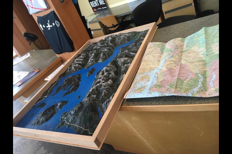
Howe Sound in miniature belongs to someone in Lions Bay.
Jody Mitchell, the founder of B.C. company Filaprint, made the two-by-three-foot 3D terrain model.
She told The Chief that she was originally looking to make a model of the most beautiful place she could think of and that was Howe Sound.
"I made it because I wanted to use it for pictures of what I do. So, I tried to think of the most beautiful place in B.C.," she said.
A private buyer near Lions Bay has since snapped it up.
Relief maps, for those unfamiliar, show the height or depth of mountains, hills, valleys, and the like in life-like models enhanced with texture and colour.
For many people in Squamish and the Lower Mainland, their first contact with such maps was likely the massive BC Challenger Relief Map of the entire province at the Pacific National Exhibition, where was on display from the 1950s to 1997.
The 24-by-23-metre map partially resurfaced in 2010 at the RCMP headquarters in Richmond as a part of the 2010 Winter Olympics Integrated Security Unit. ["Challenger B.C. Relief Map" is a Facebook page dedicated to the original map and its maker.]
Mitchell said she would love to build one like that.
"Kind of my dream," she said, with a laugh. "Still waiting for someone to knock on my door and say, 'Hey, we want a whole thing of B.C.'"
Mitchell got into the unique business of making life-like maps in 2015 after searching for a way to make income as a mom of two kids. She set her mind on 3D printing and then found her niche.
"I really loved the mountains and was sitting on top of a mountain one day after a big hike and I was like, 'Man, if only I could just print these so everyone could see them.'"
The rest is history. She has a room that is a "nerd's paradise" in her house, she said, with all she needs to create the maps.
She uses "eco-friendly" plastics and other locally sourced building materials to create the land replicas.
Her clients include tourism centres, land, and liquefied natural gas developers. She created one for the proposed LNG plant in Kitimat, for example.
"I can print what is underneath sea level, so they can see where it would be best for their ships to go and get models of their routes."
The companies use the models internally, or when showcasing their plans to the community, she said.
"It is neat to be able to build those interactive, community engagement pieces."
A map begins when a client approaches Mitchell with a size or a budget they want for their map. She goes online to different sites for the data — usually satellites, but sometimes she pays a private company for specific data — of the area the buyer wants to be re-created.
She 3D prints the file in tiles, then she hand-welds them together into one piece.
"That takes a long time because each piece has to be hand welded to be smooth all across, so you can't see the seams," she said.
Then she spray or hand paints and adds in trail systems or ski hills, or whatever the client wants.
Her two boys sometimes get involved with the process and like to test out their Legos on the worlds Mitchell creates, she said.
Depending on the size of maps clients commission, she takes on several projects a year.
For more on her work, go to www.filaprint.ca
**Please note, this story has been corrected since it was first posted. The previous version had the wrong year for the start of Mitchell's company.


