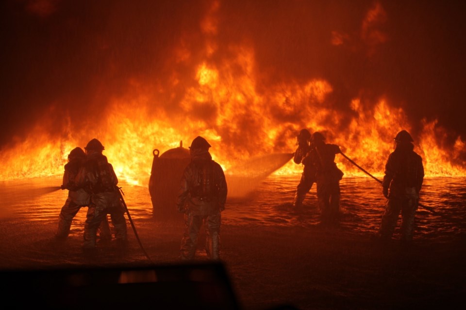
Fort McMurray’s Tara Power was downstairs, working on her home-based clothing line, as unbeknownst to her, a wildfire moved dangerously close.
When she had gone downstairs earlier that morning of May 3, 2016, the sky had been clear. When she came back up at about 11 a.m. the cluster of homes in the neighbourhood over the hill behind her home was "a wall of flames."
"I was like, 'Oh my God. Something is seriously wrong" she said.
Wildfires in the summer are common in Fort Mac, as they have become in B.C. This one had been a topic of conversation in town on and off for about a week, Power said.
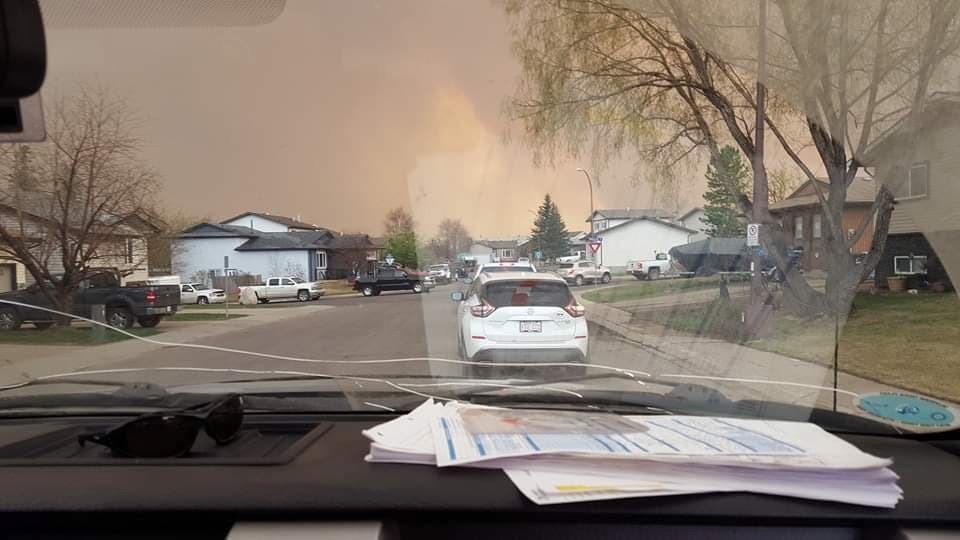
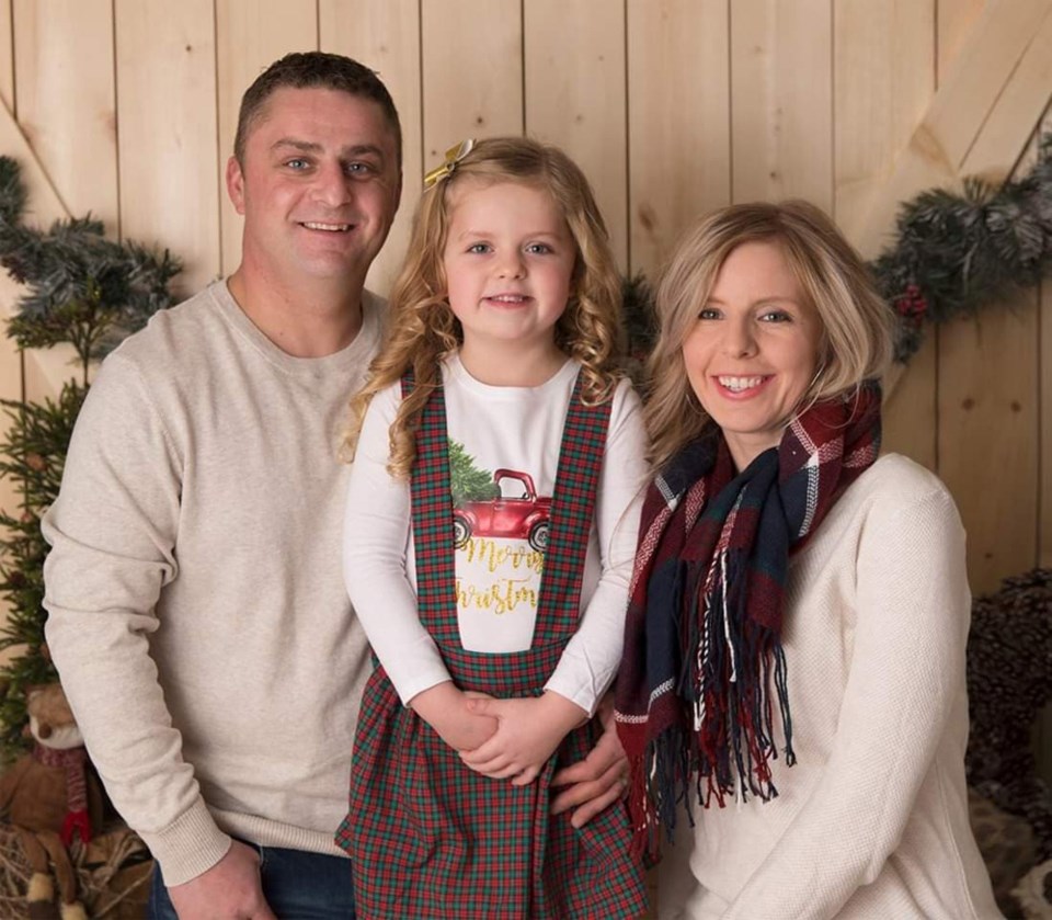
With flames and smoke moving in, Power's husband Ryan rushed home from work and the couple fled with their three-year-old daughter, Riley.
"It was chaos," Power recalled.
In the end, all 88,0000 residents of the Regional Municipality of Wood Buffalo were evacuated.
The fire spread over 590,000 hectares until it was fully declared out on August 2, 2017.
As they headed out of town, there were lineups at the gas stations and traffic were bumper to bumper.
Like Squamish, there is one main artery out of Fort Mac.
"We were driving through flames at certain points," Power recalled. "There was flaming ash falling everywhere."
The first night, the family stayed with friends who were camping a few hours out of town.
Because of the traffic, what would have been normally a two-hour trip, took more than 12 hours.
The second day the family made their way to Edmonton, thinking it would be a night or two in a hotel until they could return home.
They were unable to return for six weeks. Lucky for them, they had a home to return to. Many weren't so lucky.
Approximately 2,400 homes and buildings were destroyed.
The fire left its mark on even the homes it avoided. Many had fridges so full of rotten, smelly food that the appliances had to be thrown out. And there was the smoke damage to contend with.
The first weeks home for the Powers were spent doing dozens of loads full of laundry, trying to get the stench out of everything.
"I can still smell it in the basement sometimes," Power said.
For B.C., the 2017 and 2018 fire seasons were record-breaking, taking out more than 1.2 million hectares, eight times more than the 10-year average, according to a report by the Sierra Club of B.C.
What about Squamish?
Squamish Fire Rescue Chief Bill Stoner calls the threat of wildfire in the "Top 5" of concerns for Squamish.
And the report "Adapting to Climate Change in Squamish: backgrounder report" identifies increased forest fires as a priority.
While high danger days can extend into October, the months with the highest number of high or extreme fire danger days in Squamish are in June, July, and August, according to weather data.
About 70 per cent of Squamish is considered as having a moderate, high or extreme wildfire threat rating, according to the Provincial Wildfire Threat Analysis.
The updated District of Squamish Community Wildfire Protection Plan, adopted by council in September, lays out 48 recommendations for the municipality.
These will be addressed in the municipal budgets over years.
The Squamish wildfire plan by on Scribd
Of these recommendations, expanding the FireSmart program locally is one of the main takeaways, according to Stoner.
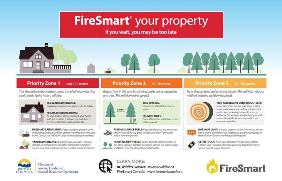
FireSmart is a national set of practices and programs to reduce losses from wildfire.
The initiative includes, among other things, education, vegetation management, legislation and planning, development guidelines, co-operation between agencies, and emergency planning.
"With the effectiveness of FireSmart, when they look at places like Fort McMurray and they look at the houses that incredibly survived... they were the ones that were laid out in a FireSmart matter — they didn't have ladder fuels next to their house, around their house was clear. These ones survived."
Using FireSmart protocols reduces ignitable fuel, as much as possible, from around your house.
One initiative, therefore, would be to provide homeowners with a list of more fire-resistant plants for around their homes.
The District has applied for a $100,000 Community Resiliency Investment (CRI) program grant from the province that, if received, will enable the fire department to do further FireSmart initiatives, Stoner said — hitting soft and hard mitigation methods that are in the high or moderate zones identified in the report.
"It will allow us to deal with a lot of the recommendations in there that are a high priority."
The funds would also be used for fuel management treatment for high-risk areas.
The local areas of priority for FireSmart programming are North Tantalus/Depot roads, which is at extreme wildfire risk rating and the Paradise Valley area, which has a high rating. The Garibaldi Highlands, Valleycliffe, Brackendale, Alice Lake Park campsites and the Sea to Sky Gondola all have a moderate risk but are also priority areas for FireSmart.
Community members are encouraged to become FireSmart champions, Stoner said. (People can call the District to put their names forward or for more information
"Our 20,000 person community is made up of communities within that, that are neighbourhoods," said Stoner. "The way the FireSmart community program works is working within those neighbourhoods — coming up with champions, people who can be FireSmart advocates."
The volunteer champions will be trained by Squamish Fire Rescue to help out.
Though the District would like to expand its FireSmart initiatives, the program isn't new to Squamish.
Last year, Squamish Rescue took a wood chipper around high priority areas so that homeowners could remove items, such as a cedar tree leaning against a building, by using the chipper, Stoner said. That will continue this year.
A sprinkle trailer was also purchased that is a shared resource with Whistler.
"We set up sprinklers around critical infrastructure or a little neighbourhood that would be the first affected, and it puts those embers out as they are coming out, reducing the ability for wildfires to spread," said Stoner. "It is a great resource that we have that is available to Whistler or Squamish almost immediately, while we are waiting for those other big resources to come in."
The Squamish wildfire plan, by consultants Blackwell and Associates, notes that the highway is the only reliable, paved assess route. "Many developments within the District are located on single access roads, which branch off of Highway 99, which also limits the ability of Squamish Fire Rescue to respond to fires and safely evacuate residents," reads the report.
"We want to make sure if you are building on the interface, you are building smart so, we want to create a wildland interface development area," Stoner said.
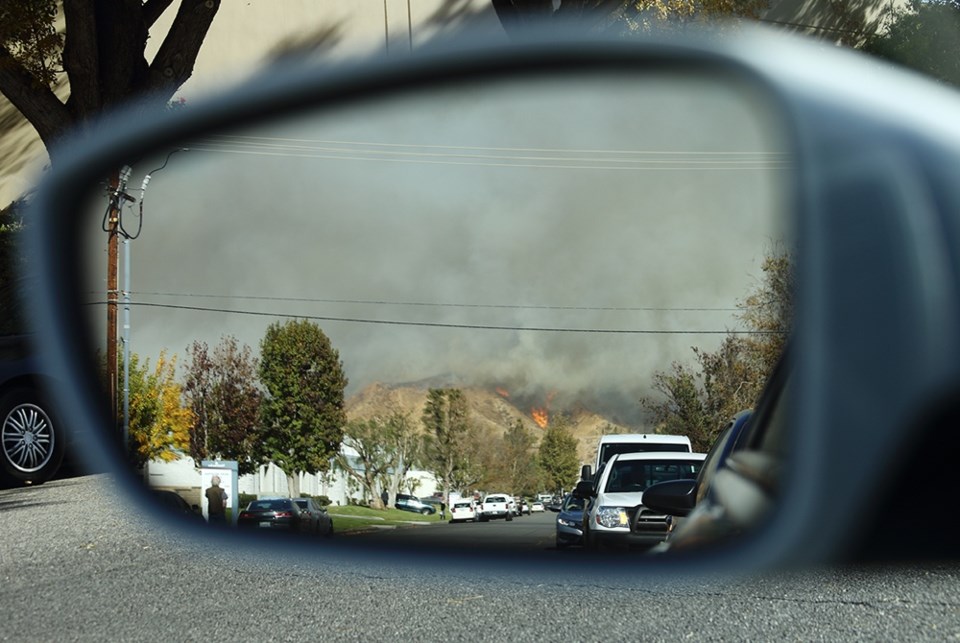
Evacuation
One common concern of the public is the prospect of a wildfire that crosses and thus blocks Highway 99.
"That is a very possible scenario," said Megan Latimer, Squamish Emergency Program co-ordinator, adding the District has been working on regional evacuation planning with the Resort Municipality of Whistler.
The District's emergency planning is outlined in the Comprehensive Emergency Management Plan which includes the District's Community Risk Assessment report and the All Hazards Plan.
"It is actually quite unprecedented in B.C. to have all of that forward planning in place at that level," said Latimer. "To know that it might take us 12 hours to evacuate certain parts of the community — and so what can we do that happens in a very efficient manner that is pleasant as possible for people and the least stressful and that isn't causing other accidents or issues."
The evacuation plan doesn't rely just on the highway, but alternative ways to get people out of the community in case of fire.
"It is also looking at other modalities such as the emergency ferry plan that BC Ferries has in place for Darrell Bay and Porteau Cove... the province is in discussions with BC Rail to explore that option; by air, to be able to take our high priority cases to take to the hospital."
Specific fire plans have also been developed for the SLRD, the Squamish Nation and Whistler.
A request for information about this plan made to the Squamish Nation was not answered.
Perhaps the biggest threat to Squamish is people, according to BC Wildfire Service data.
Within the Squamish study area, 87 per cent of wildfires sparked since 1950 have been human-caused, versus 55 per cent in the province of BC.
"This statistic may be explained by the high recreational use of many parts of [the area] specifically for camping," reads the consultants’ report to the District.
For any emergency, but in particular for wildfire, if people can be prepared for 72 hours and be ready to leave very quickly if they have to," said Latimer. "Having all their supplies in place and being able to bring them with them, makes things more comfortable and nice when you are going to a reception centre."
The District has plenty of information to help families prepare at squamish.ca/our-services/emergency-program/preparedness/.
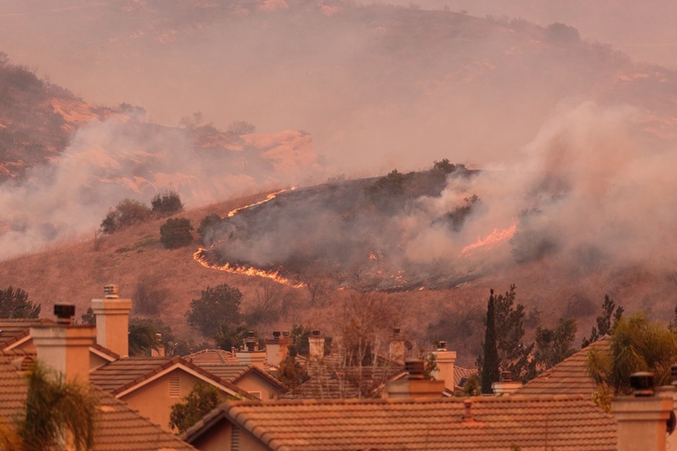
CLIMATE CHANGE AND FIRE
The amount of forest burned in Canada has doubled since the 1970s.
Mike Flannigan, a professor with the Department of Renewable Resources at the University of Alberta, who is also the director of the Western Partnership for Wildland Fire Science attributes that increase to human-caused climate change.
"I can't be more clear than that," he said.
Three per cent of fires are over 200 hectares.
But these are responsible for 97 per cent of the area burned.
"Basically, the tail wags the dog," he said.
Three ingredients are needed for a wildfire.
First, fuel is needed— trees, needles, leaves and the like.
How dry the fuel is obviously matters.
Second, ignition is needed. People and lightning are the main causes.
Thirdly, the weather that is hot and dry.
"You need all three, but I think the weather is most important because the weather influences lightening, which is one of the ignition ingredients. Weather also dictates the fuel moisture," he said.
The dryness of the fuel determines whether the fire will start, whether it will spread and how fast it will burn.
The research Flannigan and his team have done has found that temperature is really important.
"The warmer it is, the more fire we see," he said.
The warmer it is the more lightening there is.
For every degree of warming, you get a 10 or 12 per cent increase in lightning, research shows.
"Everything else being equal, more lightning means more fire."
The warmer it is, the drier fuels will be, unless there is an increase in precipitation, but prediction models of the future show that there won't be enough precipitation to compensate for the drying effect.
"If we see this warming, our fuels will be drier, which means it will be easier for fires to start, spread and burn more intensely."
The more intensely a fire burns, the more smoke goes into the atmosphere. The higher the intensity, fires also become difficult if not impossible to put out, he said.
"There's a misconception among the public that fire management can put out all fires, and that is just not true," he said. Under hot and dry conditions, so-called "crown fires," when the fire spreads from the surface into the crowns of trees and the crowns get engulfed, "the ability to stop it by direct attack is almost zero," he said.
The California wildfire last summer that killed approximately 100 people, including several firefighters, was this type of fire, Flannigan said.
BC had record-breaking wildfire seasons in 2017 and 2018, over four per cent of the forest burned in the last two years, more than the previous 28 years.
A third bad year is possible, Flannigan said.
"96 per cent of the forest is still there to burn, so yes, you could have another bad fire season. We don't know until we see the day-to-day weather," he said. "We've never seen three in a row, but with climate change, we can't rely on our experience from history. Things are completely different."
The changing jet stream, due to climate change, is also an issue.
This can seem complicated, so let's break it down.
Jet streams — air currents meandering around the earth — have been acting strangely.
"In the northern hemisphere, Arctic areas are warming up faster than equatorial areas,” said Flannigan.
The temperature difference between the two, therefore, is shrinking.
It is that temperature difference where the energy for the jet stream comes from.
So, instead of a fast moving river like flow, the jet stream is becoming a slow meandering river that stagnates.
"Where the high pressure stagnates... air sinks, warms and dries. That is what happened in 2017 and 2018. This upper ridge was persistent and strong."
Fire people have known for almost five decades that upper ridges are "very conducive to fire."
"You are seeing more extremes with this jet stream stalling pattern."
"Recent work suggests the way the arctic ice is melting, it is actually anchoring this ridge over western North America, so it is lasting longer and stronger and there are concerns some years it will be there 12 months of the year — then year-round fire seasons."
Flannigan said more federal research funding into wildfires is needed.
There isn't much in terms of funding happening now, he said, despite the publicity around the Fort Mac fire and tragedy this summer in California.
THE CLIMATE CHANGE LOOP
When wildfires burn, they emit greenhouse gasses.
The more fires we have that burn more fuel the more emissions.
"These can be significant," Flannigan said.
In some years, Indonesia has been estimated to contribute 10 to 40 percent as much greenhouse gas to the atmosphere as all the world’s fossil fuel burning, according to MIT News.
The reason this matters is that Canada, Alaska, and Siberia have 30 times more peat, decomposed plant (humus) material than Indonesia.
"It has been building up over years and fire can come through and burn through thousands of years of organic material, right up into the atmosphere," Flannigan said. "The more greenhouse gases we have the warmer we get. The warmer we get, the more fires we have. The more fires we have the more greenhouse gases are emitted. So, it could potentially be a positive feedback."
The Sierra Club BC has called on the provincial government to include wildfire emissions in its carbon emissions tally, something not currently done.
Minister George Heyman, BC's Minister of Environment and Climate Change Strategy said it is something the government is aware of.
"We do report them, although we don't report them as part of the official tally of emissions that we're reducing because that is, in fact, international practice, to only count human-caused emissions," Heymen told CBC's CBC Daybreak South in January. "But we will certainly be looking with my staff at how we account for these emissions, how we report them to BCers, and most importantly, working with my colleagues around the measures we can take to work to prevent wildfires and store carbon in forests instead of releasing it."

Power's advice
Have a plastic tub in case of emergency with not only necessities, but pictures and mementos. And now, when there isn't an emergency situation, walk through the house and take video of your home now. If it should be burned, you will be asked to recall what was in it.
In hindsight
Insights from Jody Butz, regional Fire Chief, and director of emergency management of the Regional Municipality of Wood Buffalo (Fort Mac)
Embers catching other combustible material on fire around the house ignited most homes that caught fire on the outer edges of the neighbourhoods.
Fire studies have shown that in most fires homes don't partially burn, they either burn down or don't catch fire.
Once one house or building is on fire, the risk of spread increases.
"The heat builds up, one house, to two houses to three houses — then you have intense heat."
The key is making sure they don't ignite.
"You want to have the small, quick attack. You want to be mobile. You want to be able to pump and roll," he said.
With Fort Mac, the entire town was evacuated, Butz noted, which created challenges in fighting the fire.
"We rely on the public telling us there is something going on and then we go. In a wildfire situation... everybody is gone and no one is watching the city for you."
Thus, ember transfer was harder to detect as the majority of firefighters were fighting the wall of wildfire.
"If you could link up with forestry, that was the most effective thing we could do."
These small teams of forestry personnel went around putting out spot fires, he said.
"If you can stop that little spot fire from starting, then it stops the house from getting on fire."
A municipality's main focus should not be on the response, Butz said.
Often municipalities’ focus on what apparatus they can buy, which is a mistake. "This is Mother Nature and she is fast and powerful. She is going to do what she is going to do," he said.
"Quite frankly, with the fire we experienced, there was no way we would have had enough response capability to deal with what we dealt with," he said. "It hit us in a five-kilometre span all at once and it encroached into town, in seven different places. Right away, it taps out your resources."
FAST FACTS
*Squamish Fire Rescue has two paid chiefs, six paid career firefighters and about 50 volunteers, paid-on-call volunteer firefighters. Firefighters receive wildfire training annually.
*Squamish Fire Rescue has three structural fire engines (600 to 800-gallon capacity); one wildfire response truck (250 gallons); one 75-foot ladder (300 gallons).
*Public Works has one 2,000-gallon tank and two smaller trailer tanks.
*The Woodfibre LNG power generation plant and the District land around it would be the responsibility of the BC Wildfire Service. Firefighters from Squamish would be transported by helicopter, in the event of a wildfire
*The District has 647 hydrants tested annually
PAST WILDFIRES OF NOTE
* 2015 Boulder Creek wildfire burned more than 20,000 hectares and caused the evacuation of the Innergex independent power plant
