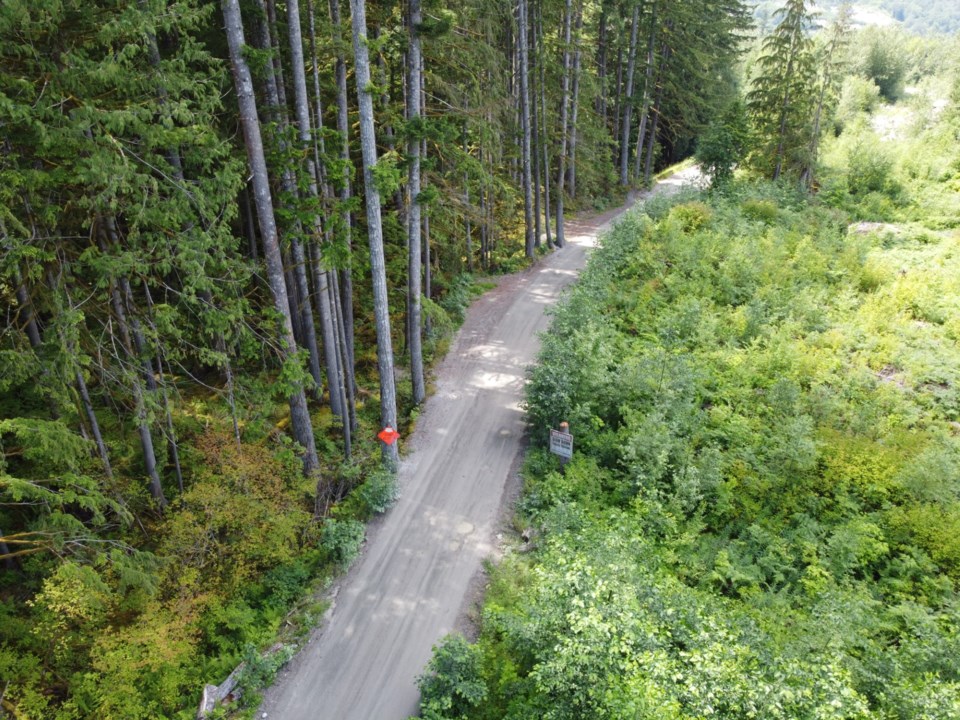
There is still more work to be completed on the Mamquam-Ring Creek Road before it is considered safe for industrial traffic.
The District organized a risk assessment on the road which revealed six hazards that could impact road user safety.
The assessment was undertaken in August by a geotechnical engineer retained by the District.
On Nov. 26, council received the Mamquam Ring Road Failure Repairs Update report which informed councillors of the hazards and how to best fix them.
Background
An atmospheric river in 2021 caused significant damage to the Mamquam-Ring Road including cracking and erosion along a number of areas.
“There was [also] a landslide on one of the upper portions of the road that was on private property,” Jesse Morwood, capital projects manager at the District of Squamish said in the meeting.
Previously, the road was used by industrial and recreational vehicles; it was also a secondary emergency access road for the University Heights area.
Due to the damage, the road has been closed to all users since 2021.
Morwood said work to repair the atmospheric river damage was completed in the spring of 2023, but more cracking was identified in 2024 due to subsequent wet weather events.
According to Morwood, the District has spent approximately $475,000 to date on the repairs with some of this reimbursed through government grant programs.
New issues
The risk assessment revealed six hazards which could impact road user safety.
“That included slumping and tension cracking of the roadway; slope erosion, undercutting of the slope from the Mamquam River, a deep-seated slope instability, rock fall from the upper slope, slumping of the upper slope due to over-steepened slopes or erosion and seepage,” Morwood said.
“The results of the risk assessment showed that there is a one in 3,900 risk to loss of life for an individual driver that makes 100 trips per year.”
The report compared this risk to other voluntary risks seen in day-to-day life.
Driving in B.C. has a one in 10,000 chance of life loss risk per year, a one in 65,000 chance of electrocution per year, a one in 200 chance for smoking per year and a one in 10,000 chance for skiing based on 100 hours per year.
“The risk assessment also concluded that risk from the upper slope is roughly 10 times greater than risk arising from the lower slope,” Morwood said.
The report recommends that prior to opening the road, the risks should be mitigated.
The primary recommendations are to reduce the upper slope angle, install ‘No Stopping’ and reduced speed signs, maintain an existing rockfall ditch and an existing drainage swale, and complete periodic geotechnical reviews.
The District is also collaborating with the land owner to address work on a private section, however, they “don’t have a schedule on when this work will be done” but hope it will be completed “as soon as possible.”
The future
Morwood said that the District's intent is to open the road to industrial traffic only.
“The reason is that in [some] locations, this road has been reduced to single lane traffic,” he said.
“Currently, the road is closed to all traffic, and the objective that we're working towards is to reopen the road to industrial traffic and to active transportation, not concurrently, but active transportation most of the time, and then during periods of industrial use that it would be solely for that use.”
The likelihood of general traffic being able to use the road is also not on the cards any time soon.
“To open the road to anything beyond that would require additional investments in the road because, as I mentioned, there are fairly lengthy single-lane sections where it's not suitable for something like reopening the road to public access in its current state,” Mordood said,
“So that would require further future investment.”
Councillors voted unanimously to receive the report.
Those interested can read the full report on the District’s website.
~With files from Jennifer Thuncher/The Squamish Chief


