—Update on Nov. 1—
Environment and natural resources Canada has released the total precipitations amounts for the month of October that give a clearer picture of the rain we saw in Squamish.
Here's the final breakdown:
•Oct. 18—Squamish Airport saw 42.2 millimetres (mm)
•Oct. 19—67.7 mm
•Oct. 20—62.7 mm
Total over the three-day storm = 172.6 mm
For the month of October, the Squamish Airport weather station saw 358.9 mm.
—Final update Monday—
As of Sunday at 5 p.m., the three-day atmospheric river storm that moved through the Sea to Sky dumped the following amount of rain: 172 mm at Squamish Airport; 79 mm at Whistler Nesters; Pemberton Airport saw 72 mm; the Callaghan Valley was soaked with 112 mm; Pam Rocks on Howe Sound was pounded by 123 mm; West Vancouver really took a hit, with 219 mm.
The Environment Canada rainfall warning was lifted Sunday.
The River Forecast Centre flood watch for our region continues.
"A flood watch means that river levels are rising and will approach or may exceed bankfull. Flooding of areas adjacent to affected rivers may occur."
—Update Sunday 2 p.m.—
How much rain have we gotten in this storm so far?
Well, an Environment Canada record for rainfall was broken in Squamish on Saturday, Oct. 19.
Squamish received 67.7 mm, smashing the old record of 67.6 mm set in 2000.
Records in this area have been kept since 1959.
According to the summary of weather event information received by Environment and Climate Change Canada, as of 5 a.m. on Sunday, Squamish has received 108 mm of rain since the storm began on Friday.
Brandywine has received 75 mm, and Whistler has received 54 mm.
Coquitlam, on the other hand, which has seen a house slide away in a landslide triggered by the rain, has received 161 to 228 mm, and West Vancouver, which was also hard hit, has received 177 mm.
After being pounded by rain all weekend, as a result of the atmospheric river moving through the south coast, the River Forecast Centre flood watch remains in effect in our Howe Sound, Sea to Sky region.
"A flood watch means that river levels are rising and will approach or may exceed bankfull. Flooding of areas adjacent to affected rivers may occur."
The Environment Canada rainfall warning remains in effect, though the heavy rain is expected to ease this afternoon.
Tonight, we can expect a few showers, transitioning to mostly cloudy with a 40 % chance of showers.
The winds will be light tonight, except south 30 km/h over southern sections early this evening.
Monday, we can expect it to be mainly cloudy with a 30% chance of showers.
We will see a high of 10 C today and a low down to 5 C overnight.
—Update Oct. 20—
As of Sunday morning, an Environment Canada rainfall warning remains in effect for Squamish.
"A strong fall storm brought heavy rain across much of the South Coast. Rain has eased across the region last night but is expected to return this morning and last through much of today," reads the alert.
The River Forecast Centre flood watch also remains in effect in our region.
"A flood watch means that river levels are rising and will approach or may exceed bankfull. Flooding of areas adjacent to affected rivers may occur."
—Original story below—
Squamish meteorologist Jason Ross says the "steady conveyor belt" of heavy rainfall isn't over yet.
As some folks headed out to vote this election day in Squamish, they were pelted by steady rain.
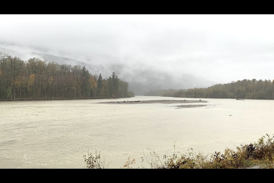
Puddles have formed on most roads, and the rivers are visibly higher.
As of 4 p.m. on Oct. 19, since the start of the atmospheric river, Squamish Airport has seen 105 millimetres of rain, Whistler's Nesters station has seen 50 mm, Pemberton Airport has seen 38 mm; the Callaghan Valley has seen 68 mm, while Pam Rocks on Howe Sound has seen 94mm.
In West Vancouver, folks have seen 156 mm.
An Environment Canada rainfall warning remains in effect for Squamish, Whistler and Metro Vancouver, as well as western and central Fraser Valley.
The River Forecast Centre is maintaining a flood watch for Squamish.
"A flood watch means that river levels are rising and will approach or may exceed bankfull. Flooding of areas adjacent to affected rivers may occur."
So far, while the rivers are definitely swollen in Squamish, the district has been relatively unscathed.
Other areas, however, have not been so lucky.
The Lower Mainland has seen widespread flooding.
Closer to home, West Vancouver Police warned residents that westbound and eastbound ramps to Highway 1 at 21st St were closed due to flooding.
"Pooling water and popped manholes [are] causing issues along Marine Drive from Taylor Way to 24th Street," read a post to X by the West Van police.
North Shore Emergency Management warned folks in North and West Vancouver to "stay out of parks, forested areas, steep slopes [plus] all waterways" during the storm.
As for what more is in store for Squamish, the Environment Canada warning says that a "second pulse of rain" is expected Sunday before it ends later that day.
"Ensure that drains are clear of leaves and debris and secure loose objects out-of-doors," the warning notes.


