Heavy rain sweeping across southern and central British Columbia has intensified an already difficult flood situation along numerous rivers, creeks and streams.
The forecast has prompted a warning from the provincial government for people living near the swelling waterways to be prepared to get out quickly.
A week of record temperatures has quickly melted mountain snowpacks. Environment Canada said 19 daily heat records were broken Thursday in B.C.'s Interior, including in Kelowna, where the temperature exceeded a peak set in 1900.
The weather office has issued severe thunderstorm watches for the Boundary and Okanagan regions, saying heavy downpours are likely to cause flash floods.
A lower-level bulletin covers the neighbouring West Kootenay region, where Environment Canada said heavy rain could contribute to mudslides and flooding.
The rain is expected to persist through Saturday night.
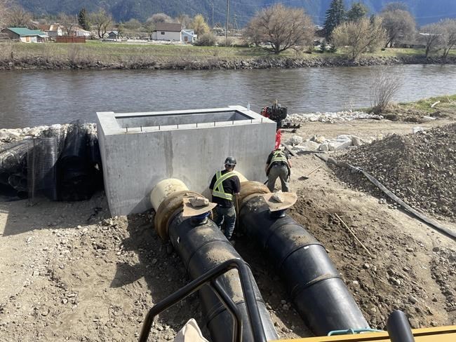
Everett Baker, the mayor of Grand Forks, B.C., said he is confident the community's downtown is prepared for a 200-year flood.
The city of about 4,100 residents not far from the Canada-U.S. border already endured a major flood in 2018, losing 95 homes.
He said they've protected what they can.
"I have great confidence in our flood mitigation program that will do the job it needs to do in the downtown core and protect industry," he said, while watching the rain come down from his office window on Friday.
"Is it enough? I guess Monday morning will tell that story."
A statement from the Ministry of Emergency Management on Friday said people in at-risk areas should be ready with a household plan and grab-and-go bags filled with essentials, should they need to leave their homes.
B.C.'s River Forecast Centre has issued flood warnings for the Boundary Region, including the Kettle and Granby rivers that run through Grand Forks.
A flood warning has also been posted for the Lower Thompson region, including Cache Creek, Criss Creek and the Bonaparte and Deadman rivers.
Low-level flood watches cover the Kootenay region; the Similkameen, Okanagan and Salmon rivers; and the middle Fraser River, including its plateau around Quesnel and Williams Lake.
High streamflow advisories have been issued for the Coquihalla River, the Nicola and Shuswap rivers and their tributaries, the upper Fraser River and the surrounding areas, and the Skeena region, including the Bulkley River.
Parts of the village of Cache Creek, about 80 kilometres west of Kamloops, remain inundated by floodwaters that flowed through the community's firehall as well as businesses and several homes.
Village Mayor John Ranta said this week the normally babbling brook became a raging river.
The village's Facebook page on Friday said 21 properties have been evacuated, with more on alert as floodwaters cut through the downtown.
Highways 1 and 97 had been closed in both directions as they intersect Cache Creek, but the routes have since reopened to single-lane alternating traffic.
At Canada's Best Value Inn & Suites in Cache Creek, maintenance worker Craig Poljer joked that he wasn't even aware of the day because he's been so busy piling sandbags and cleaning mud out of rooms with two other housekeepers.
He said they were lucky because the inn is on higher ground.
"The rooms are higher up, so we are not going to get flooding in the rooms. Not like other motels that are going to be shut down for probably six months to a year while they get cleaned up," said Poljer.
"We're good in the hotel. (I am) so sorry about the other ones that are all damaged."
Amelia Hillyard, a Cache Creek resident and employee at the Sunset Motel, said many businesses and schools shut down because the highway was closed.
She said people have been supporting each other.
"It's been difficult being the community itself is split by the river. So, on one side we can't get to each other. So, that's definitely been a big challenge," she said.
The Okanagan Indian Band has placed several properties on evacuation order in the neighbourhood of Parker Cove on Okanagan Lake, west of Vernon, where it said floodwaters from Whiteman Creek have eroded land and undercut trees.
An update posted Friday afternoon said 100 evacuees from 55 households in that area had registered with the province's emergency support service program.
So far, 10 properties in Grand Forks are under evacuation order while another 34 have been placed on evacuation alert due to flood risk.
The Regional District of Kootenay Boundary has issued an alert for an additional 591 properties affecting an estimated 1,182 people in the surrounding area. It has also put 47 properties for the village of Midway in floodplain on the banks of the Kettle River on evacuation alert.
The Regional District of Central Kootenay issued an evacuation alert Friday for 892 properties in the village of Salmo and the communities of Erie and Ymir. It later issued an evacuation alert for Duhamel Creek, near Nelson. The district said heavy rain in the forecast could threaten the structural integrity of the Duhamel Creek dike.
It said Erie Creek, the Salmo River and all surrounding tributaries are rising and people should remain vigilant and be prepared to leave at a moment’s notice.
Baker, in Grand Forks, said many residents don't qualify for overland flood insurance. Depending on how things progress this weekend, the community would have to ask for financial help from the provincial and federal governments to cover any damage, he said.
The mayor said he's confident the other levels of government would step up to help and that Bowinn Ma, B.C.'s minister of emergency management, has called him to see how the community is doing.
The province's statement said residents living in high-risk areas are encouraged to connect with their neighbours, self-register for emergency support services and stay connected with their local government or First Nation for updates.
This report by The Canadian Press was first published May 5, 2023.
The Canadian Press


