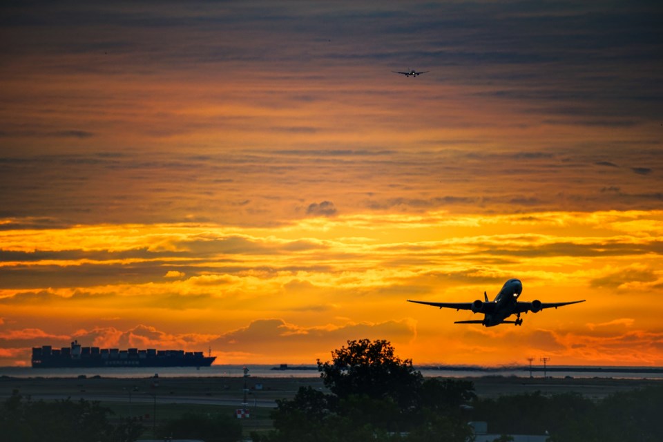
While it’s unknown by exactly how much, sea levels are expected to rise during this century, thanks to climate change.
The U.N.’s Intergovernmental Panel on Climate Change (IPCC) estimates the sea level could rise by as much as 1 metre by 2100, or just over 3 feet.
The IPCC came up with this estimate based on an emissions scenario of RCP 8.5 (RCP stands for representative concentration pathway), which models based on what will happen if emissions continue to rise in their current trajectory—the “business as usual” scenario. And this IPCC estimate does not take ice sheet melting into account, which some studies suggest could make the sea-level rise even greater.
Even with an aggressive global reduction of carbon emissions, some scenarios still predict a sea-level rise of a 0.5 metre. If either of these scenarios come to pass, it will have numerous and grave consequences for communities and infrastructure around the world.
Resource Watch, a research platform run by the World Resources Institute, conducted a study in February 2020 to analyze how this sea-level rise would impact one type of infrastructure in particular: airports.
It did this by taking Climate Central data on how sea level rises of both 0.5 metre and 1 metre would impact different parts of the world. They then combined that data with altitude, elevation, and geographic data from OpenFlights. This gave it a list of 80 airports threatened by rising sea levels. Out of these 80 airports, 44 will be impacted with a sea-level rise of just a 0.5 metre. The other 36 won’t be under threat until sea level reaches 1 metre or more.
Stacker chose 30 of the 80 airports highlighted by the Resource Watch study. Some of these airports are big, like Amsterdam’s Schiphol Airport, the 11th busiest in the world.
Some are small, like Edward Bodden Airfield, located on Little Cayman Island. Many are located on islands, which are naturally vulnerable to sea-level rise.
Three of these airports are in the Netherlands, a country with a significant amount of land below sea level. A number are located in China. Many others are situated on island nations, which are already struggling with the impacts of climate change. Some are naval airports.
What they all have in common is that by 2100, they may no longer exist.
T.W. van Urk // Shutterstock
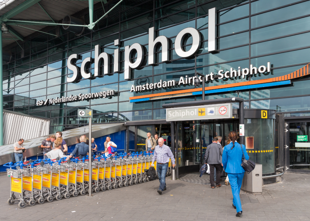
Amsterdam Airport Schiphol
- Location: Amsterdam, Netherlands
- Airport codes: AMS (IATA), EHAM (ICAO)
- Threatened by: 0.5 metre or more of sea-level rise
Amsterdam Airport Schiphol (AMS) is the 11th busiest airport in the world, with more than 71 million travellers flying in or out or transferring through it in 2019. (Numbers dropped precipitously in 2020 due to the pandemic). With just a 0.5 metre of sea-level rise, it could be flooded by the North Sea. However, this does not take into account flood prevention strategies, and the Netherlands is one of the world leaders in water management.
Ralf Roletschek // Wikimedia Commons
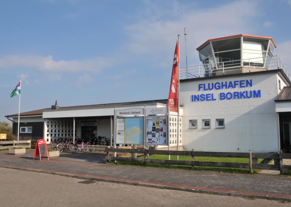
Borkum Airport
- Location: Borkum, Germany
- Airport codes: BMK (IATA), EDWR (ICAO)
- Threatened by: 1 metre or more of sea-level rise
Borkum Airfield (BMK) serves Borkum, a small island of roughly 5,125 residents located in the North Sea on the northwest coast of Germany. Its location on an island leaves it vulnerable to flooding with 1 metre or more of sea-level rise. In 2013, residents of the island were advised to seek higher ground during Hurricane Xavier.
Muumin11 // Wikimedia Commons
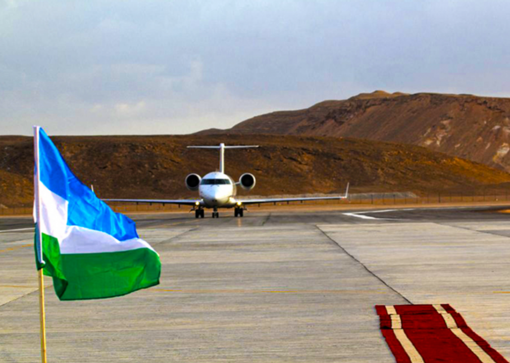
Bosaso Airport
- Location: Bosaso, Somalia
- Airport codes: BSA (IATA), HCMF (ICAO)
- Threatened by: 1 metre or more of sea-level rise
Somalia’s Bosaso Airport (BSA), also known as Bender Qassim International Airport, could be inundated by 1 metre or more of sea-level rise. The airport is located along Somalia’s northern coast, on the Gulf of Aden. Somalia has been experiencing almost nonstop political instability since 1991, making it especially vulnerable to climate change events such as flooding.
Jonas Gratzer/LightRocket // Getty Images
Buariki/Aranuka Airport
- Location: Buariki, Kiribati
- Airport codes: AAK (IATA), NGUK (ICAO)
- Threatened by: 0.5 metre or more of sea-level rise
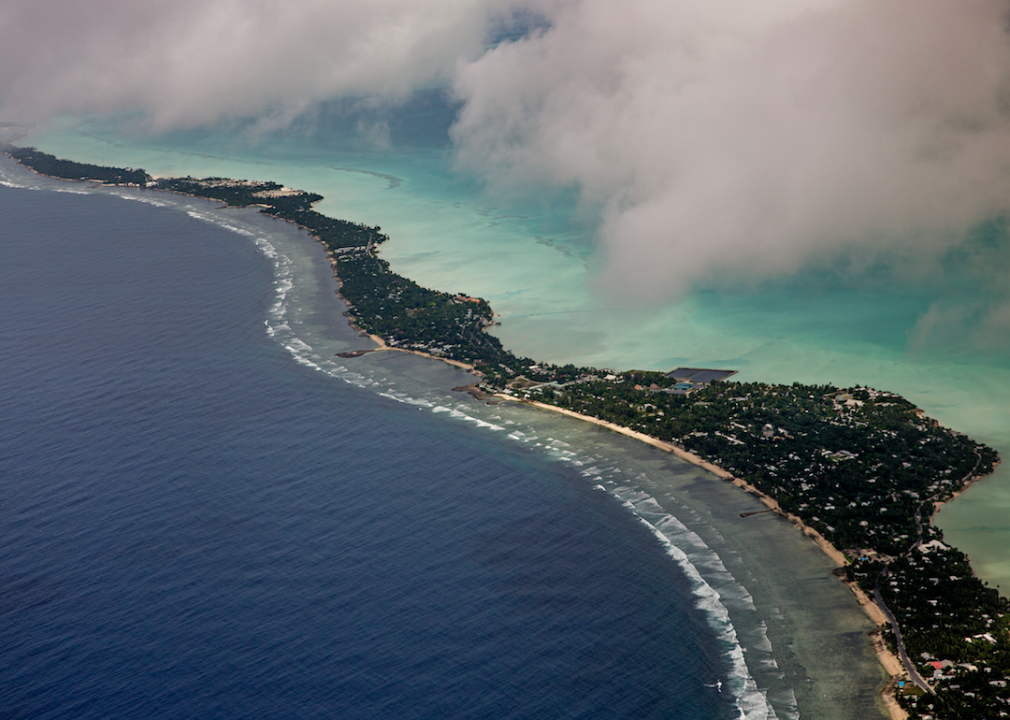
Aranuka Airport (AAK) is located near Buariki in Kiribati, a small nation in the Pacific Ocean. The country is made up of a number of atolls, and the majority of its nearly 119,000 residents live on the Tarawa atoll, which is where Buariki is located. The Aranuka airport could be underwater with just a 0.5 metre of sea-level rise. It currently runs three flights a week to Bonriki International Airport, which is on the south side of the same atoll. As a nation made of atolls and surrounded by water, Kiribati is on the front line of climate change, and much of it could be completely inundated within 25 years.
SCJiang // Wikimedia Commons
Changzhou Benniu Airport
- Location: Changzhou, China
- Airport codes: CZX (IATA), ZSCG (ICAO)
- Threatened by: 0.5 metre or more of sea-level rise
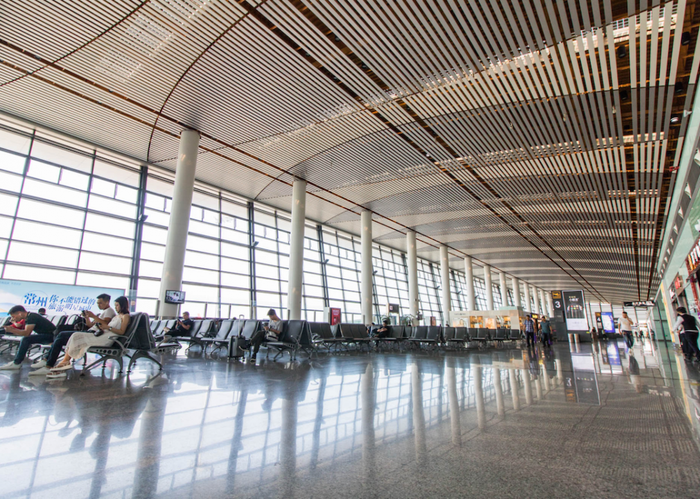
Changzhou Benniu Airport (CZX) is located near China’s eastern coast. It sits along the Yangtze River and near the East China Sea, and it could be covered by water with a 0.5 metre of sea-level rise. This airport operates flights to many other Chinese cities, such as Shenzhen, Chengdu, and Guangzhou. Changzhou is a rapidly growing city, with a current population of more than 3.5 million.
Riderfoot // Shutterstock
Corn Island Airport
- Location: Corn Island, Nicaragua
- Airport codes: RNI (IATA), MNCI (ICAO)
- Threatened by: 0.5 metre or more of sea-level rise
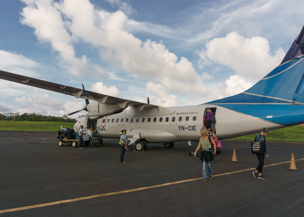
The Corn Island Airport (RNI) is located on Big Corn Island, off of Nicaragua’s east coast. It is part of Nicaragua’s South Caribbean Autonomous Region. By 2100, with a 0.5 metre of sea-level rise, the airport could be underwater. The island is working on strengthening climate resilience with the construction of seawalls, learning better-building practices, and increasing communication and outreach.
Curioso // Shutterstock
Corvo Airport
- Location: Corvo, Portugal
- Airport codes: CVU (IATA), LPCR (ICAO)
- Threatened by: 0.5 metre or more of sea-level rise
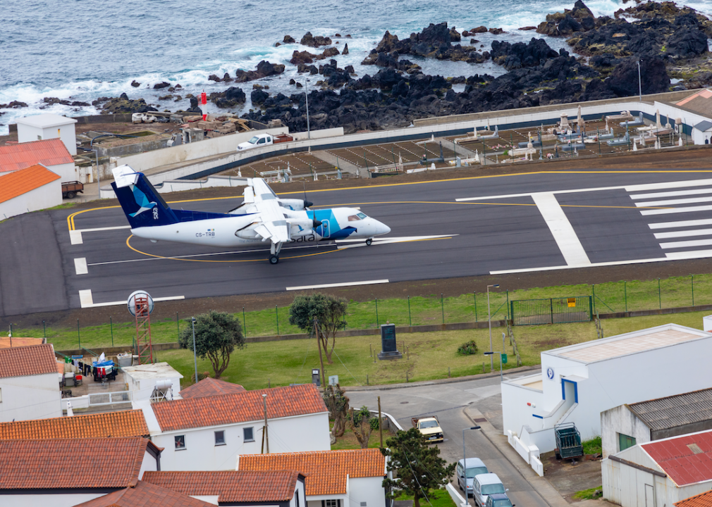
Portugal’s Corvo Airport (CVU) is in danger of having a flooded runway with a 0.5 metre of sea-level rise. It is located on the southern tip of Corvo Island, part of the Azores archipelago located in the Atlantic Ocean. The island only has 465 residents, and the airport operates flights to two destinations: Ponta Delgada (PDL) and Horta (HOR).
eric laudonien // Shutterstock
Edward Bodden Airfield
- Location: Little Cayman, Cayman Islands
- Airport codes: LYB (IATA), MWCL (ICAO)
- Threatened by: 1 metre or more of sea-level rise
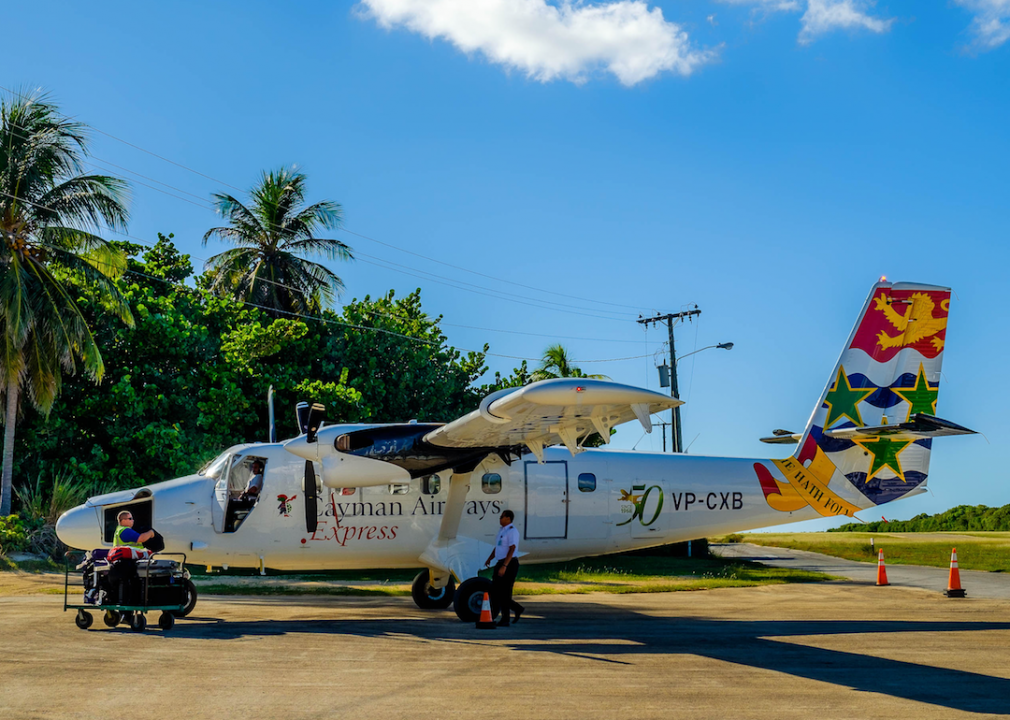
Edward Bodden Airfield (LYB) on Little Cayman Island could be underwater with 1 metre or more of sea-level rise. The small airport is located on the southwest coast of the island, right up against the Caribbean Sea. Although the island is small, with a population of fewer than 200 people, it is a popular spot for tourism activities such as scuba diving. Unfortunately, there has so far been a lack of long-term planning for the Cayman Islands when it comes to facing climate change.

U.S. Navy // Wikimedia Commons
El Centro Naf Airport
- Location: El Centro, United States
- Airport codes: NJK (IATA), KNJK (ICAO)
- Threatened by: 0.5 metre or more of sea-level rise
California’s El Centro NAF (Naval Air Facility) Airport (NJK) is a naval airport with a runway that could be underwater by the end of this century with a 0.5 metre rise in sea level. This airport is located in California’s Imperial Valley, which is below sea level.
Andrew Milligan/PA Images // Getty Images
Glasgow City Heliport
- Location: Glasgow, United Kingdom
- Airport codes: No IATA code, EGEG (ICAO)
- Threatened by: 0.5 metre or more of sea-level rise
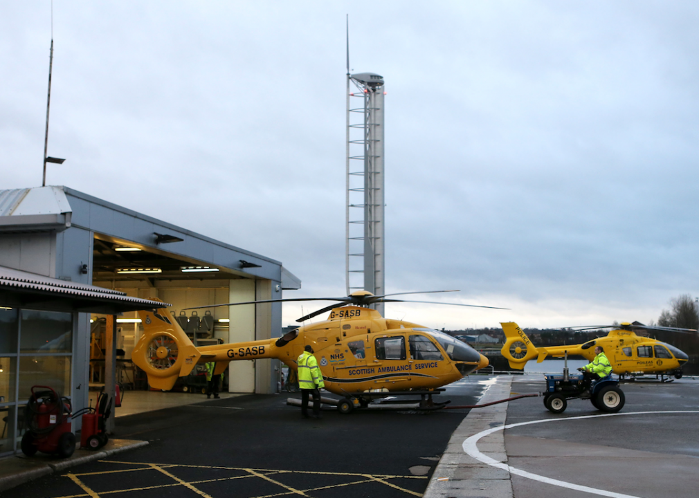
Scotland’s Glasgow City Heliport is at risk of seeing flooding from the Atlantic Ocean on its runways with a 0.5 metre of sea-level rise. The heliport is the homebase for Police Scotland's Air Support Unit. Beyond the heliport, much of Glasgow is at risk from sea-level rise, including roads, railways, and hospitals.
Treesarecool510 // Wikimedia Commons
Imperial County Airport
- Location: Imperial, United States
- Airport codes: IPL (IATA), KIPL (ICAO)
- Threatened by: 0.5 metre or more of sea-level rise
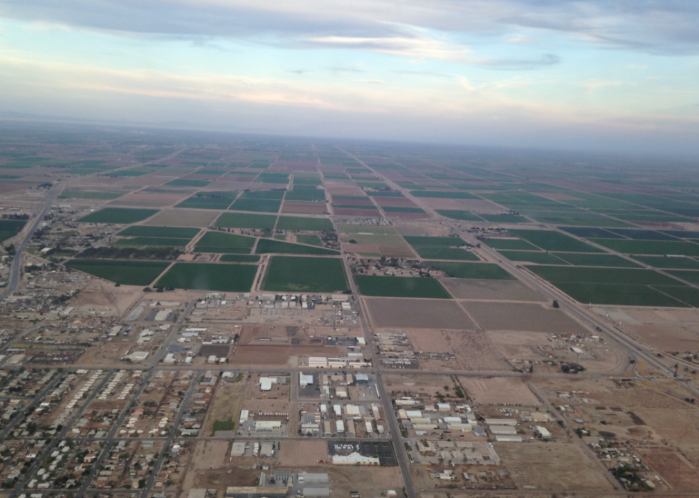
The Imperial County Airport (IPL), located in Imperial, California, could face flooding of its runways with just a 0.5 metre of sea-level rise. The valley where the airport is situated is located at an elevation of 54 feet below sea level, making it especially vulnerable to rising sea levels in the Pacific Ocean. It is a county-owned, public airport and serves the local community. It is very close to the Mexican border.
Drewski2112 // Flickr
Jacqueline Cochran Regional Airport
- Location: Palm Springs, United States
- Airport codes: TRM (IATA), KTRM (ICAO)
- Threatened by: 0.5 metre or more of sea-level rise
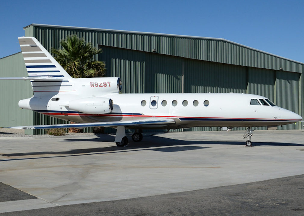
The Jacqueline Cochran Regional Airport (TRM) is located in Palm Springs, California, and will be completely flooded with a 0.5 metre of sea-level rise. The airport has 127 aircraft located onsite and runs 209 aircraft operations per day. And although the area is generally arid, it is also prone to flooding from stormwater runoff.
Anirut Thailand // Shutterstock
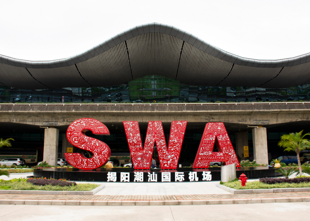
Jieyang Chaoshan International Airport
- Location: Jieyang City, China
- Airport codes: SWA (IATA), ZGOW (ICAO)
- Threatened by: 0.5 metre or more of sea-level rise
The Jieyang Chaoshan International Airport is located in Jieyang City, China, and serves the cities of Jieyang, Shantou, and Chaozhou. It has 2,800 metres of runways, which will flood with a sea-level rise of a 0.5 metre or more. Nearby Shantou sits on the delta of the Rongjiang River, which flows into the South China Sea, and 54% of the population lives in areas that would flood with a temperature rise of 4 degrees Celsius.
fvanrenterghem // Flickr
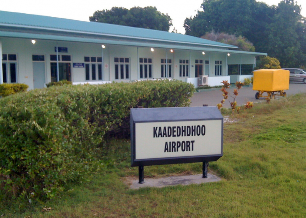
Kaadedhdhoo Airport
- Location: Kaadedhdhoo, Maldives
- Airport codes: KDM (IATA), VRMT (ICAO)
- Threatened by: 1 metre or more of sea-level rise
A sea-level rise of 1 metre or more will send the Kaadedhdhoo Airport (KDM) underwater. This airport is located in the Maldives, a small nation made up of almost 1,200 islands situated in the Arabian Sea in the Indian Ocean. This regional airport mostly operates flights to Malé, the capital of the Maldives. Due to its location, the nation has been facing the threat of sea-level rise for years. Already, the government is planning to relocate people from the most at-risk islands to artificial islands that are more flood-resistant.
ksr8s // Wikimedia Commons
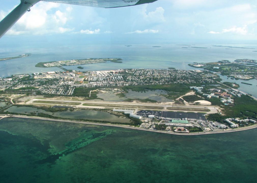
Key West International Airport
- Location: Key West, United States
- Airport codes: EYW (IATA), KEYW (ICAO)
- Threatened by: 1 metre or more of sea-level rise
Florida’s Key West International Airport (EYW) will see flooding with 1 metre or more of sea-level rise by 2100. Key West is a popular vacation destination located on an archipelago off the southern coast of Florida in the Atlantic Ocean. Typically, its airport sees between 50 and 60 commercial flights each day. COVID-19 hit hard in 2020 , but by October of that year, they were tracking as the top recovery airport in the country. Parts of the Florida Keys are already too costly to try and save from sea-level rise.
Ivo Antonie de Rooij // Shutterstock
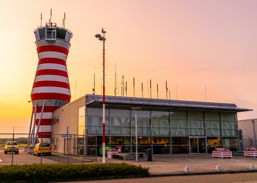
Lelystad Airport
- Location: Lelystad, Netherlands
- Airport codes: LEY (IATA), EHLE (ICAO)
- Threatened by: 0.5 metre or more of sea-level rise
With a 0.5 metre or more of sea-level rise, Lelystad Airport (LEY) in the Netherlands could end up underwater. This small airport, which runs training and sightseeing trips and offers plane rentals, is located along Lake Marker and Lake Ijssel and is close to the North Sea. However, as with Amsterdam’s Schiphol Airport, the water management strategies adopted in the Netherlands could lower Lelystad’s vulnerability.
Pawel Czuczwara // Shutterstock
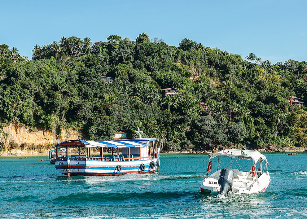
Lorenzo Airport
- Location: Morro de São Paulo, Brazil
- Airport codes: No IATA code, SNCL (ICAO)
- Threatened by: 1 metre or more of sea-level rise
The Morro de Sao Paulo-Lorenzo Airport in Brazil is on the island of Tinharé in the Atlantic Ocean. This small airstrip is expected to flood with 1 or more metres of sea-level rise. Sea-level rise in Brazil’s coastal areas is expected to cause nearly $400 million in economic damages to the country by 2100 without adaptive measures.
flyingry // Shutterstock
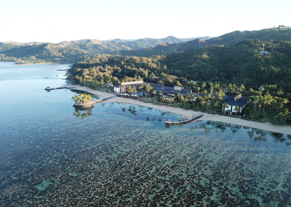
Mana Island Airport
- Location: Mana Island, Fiji
- Airport codes: MNF (IATA), NFMA (ICAO)
- Threatened by: 0.5 metre or more of sea-level rise
Mana Island Airport (MNF) is located on Mana Island, one of the more than 300 islands that makes up the nation of Fiji. With a 0.5 metre or more of sea-level rise, this airport will be flooded by water from the South Pacific Ocean. The small airport runs daily flights to Nadi, Fiji’s capital, using both regular planes through Pacific Island Air airline as well as seaplanes. While flying to Mana Island is the quickest way to get there, it is also possible to get there by ferry or water taxi.
fiid // Flickr
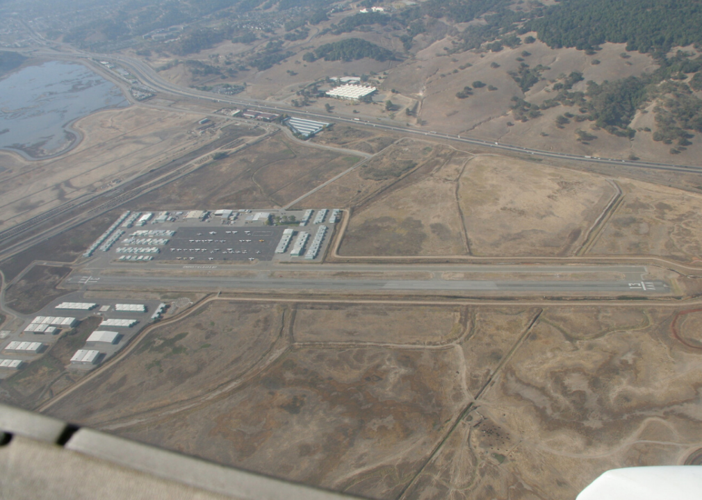
Marin County Airport—Gnoss Field
- Location: Novato, United States
- Airport codes: No IATA code, KDVO (ICAO)
- Threatened by: 1 metre or more of sea-level rise
The Marin County Airport, located in Novato, California, is operated by the Department of Public Works and is home to about 300 aircraft and businesses. With 1 metre or more of sea-level rise however, this airport may no longer be able to function due to flooding of its runways by water from the San Pablo Bay. This airport is used for both business and personal travel, government travel, and flight training, shifting air congestion away from larger airports in the San Francisco Bay area.

MosheA // Shutterstock
Muhammad Salahuddin Airport
- Location: Bima, Indonesia
- Airport codes: BMU (IATA), WADB (ICAO)
- Threatened by: 1 metre or more of sea-level rise
The Muhammad Salahuddin Airport (BMU) is located in Bima, Indonesia, on the island of Sumbawa. With 1 metre of sea-level rise, this airport could be flooded by water from the Flores Sea. This airport operates flights to cities such as Lombok, Denpasar, and Makassar, on nearby Indonesian islands.
As a nation made up of more than 17,000 islands, Indonesia is especially vulnerable to sea-level rise. There are some projects looking at resilience, such as one involving the foundation EcoShape, looking to restore mangroves to mitigate coastal erosion.
FotosForTheFuture // Shutterstock
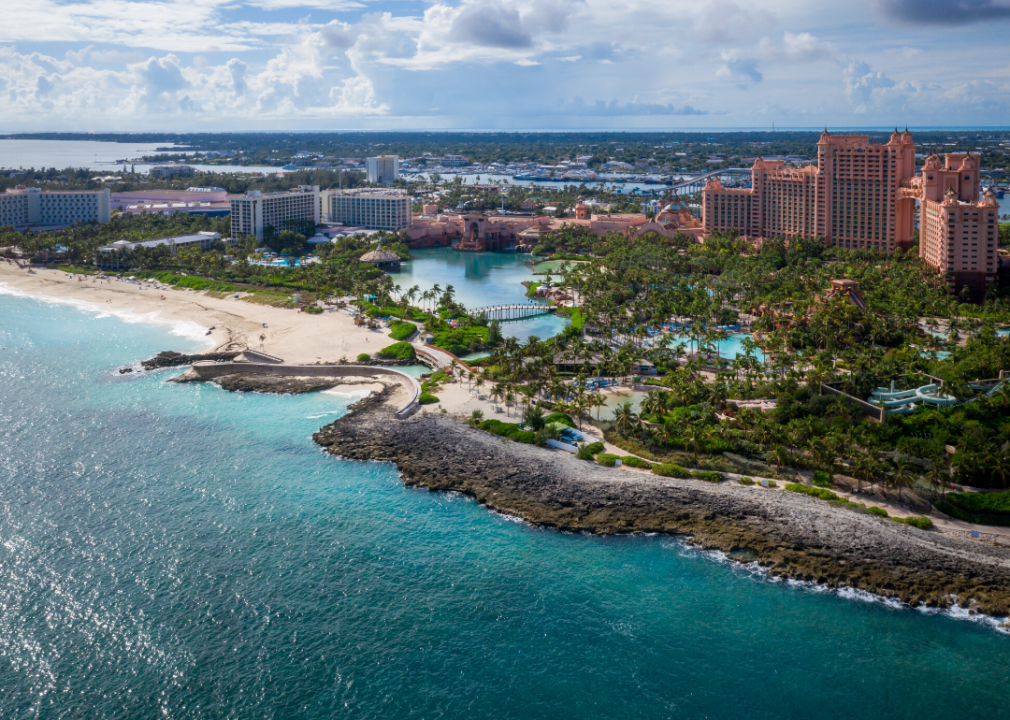
Nassau Paradise Island Airport
- Location: Nassau, Bahamas
- Airport codes: PID (IATA), MYPI (ICAO)
- Threatened by: 0.5 metre or more of sea-level rise
Nassau Paradise Island Airport (PID) located in Nassau, Bahamas, is in danger of being flooded with just a 0.5 metre of sea-level rise. Nassau is an island in the Atlantic Ocean, meaning that with sea-level rise, flooding is inevitable. Beyond the airport, the Bahamas is projected to lose a great amount of land due to sea-level rise by 2050, costing it nearly $900 million a year in tourism losses.
U.S. Air Force // Wikimedia Commons
New Orleans NAS JRB/Alvin Callender Field
- Location: New Orleans, United States
- Airport codes: NBG (IATA), KNBG (ICAO)
- Threatened by: 1 metre or more of sea-level rise
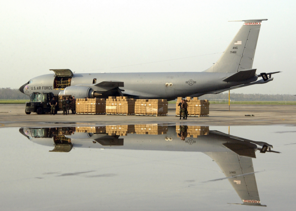
New Orleans NAS JRB/Alvin Callender Field (NBG) is a naval airport located in New Orleans, Louisiana. With 1 metre of sea-level rise, it will be underwater due to its location on the Mississippi River and proximity to the Gulf of Mexico. Although New Orleans was above sea level when it was built, it has been sinking, making it especially vulnerable to sea-level rise.
craigophoto // Shutterstock
Newcastle Aerodrome
- Location: Newcastle, Ireland
- Airport codes: No IATA code, EINC (ICAO)
- Threatened by: 0.5 metre or more of sea-level rise
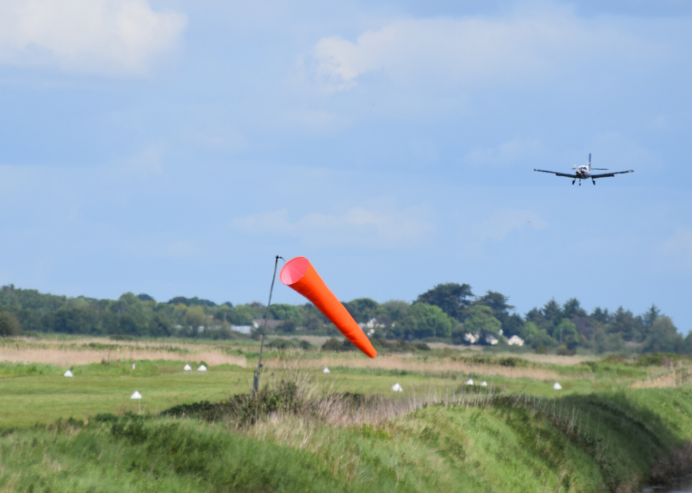
The Newcastle Aerodrome is located on Ireland’s east coast, and with a 0.5 metre or more of sea-level rise, it will experience flooding from the Irish Sea. This airfield has a 690-metre grass runway and is a 40-minute drive from Dublin. It provides private planes a place to take off and land, and it also offers flight training.
Mahdi khajoo // Wikimedia Commons
Ramsar Airport
- Location: Ramsar, Iran
- Airport codes: RZR (IATA), OINR (ICAO)
- Threatened by: 0.5 metre or more of sea-level rise
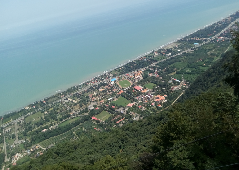
Iran’s Ramsar Airport (RZR) is located on the country’s north coast, along the Caspian Sea. With a 0.5 metre or more of sea-level rise, this airport will be flooded. The airport runs flights to and from Tehran, Iran’s capital city. It also has private and sport flights.
Markus Mainka // Shutterstock
Rotterdam The Hague Airport
- Location: Rotterdam, Netherlands
- Airport codes: RTM (IATA), EHRD (ICAO)
- Threatened by: 0.5 metre or more of sea-level rise
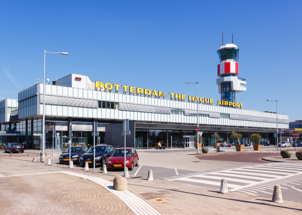
Another of the Netherlands’s airports is in danger of flooding due to sea-level rise. Rotterdam The Hague Airport (RTM) is vulnerable to just a 0.5 metre of sea-level rise. This airport, the third busiest in the Netherlands serving more than 40 destinations, is located close to the North Sea, making it prone to flooding. However, as the Netherlands is one of the leading countries in flood protection initiatives, it is possible that this airport will be spared in spite of sea levels rising.

Jonas Gratzer/LightRocket // Getty Images
Siquijor Airport
- Location: Siquijor, Philippines
- Airport codes: No IATA code, RPVZ (ICAO)
- Threatened by: 1 metre or more of sea-level rise
Siquijor Airport is located on the Philippines’ Siquijor island. With 1 metre of sea-level rise, this airport will be flooded by the Bohol Sea. As a nation of islands, the Philippines is under extreme threat from sea-level rise, and in 30 years many of its coastal areas could be underwater.
FloKrass // Wikimedia Commons
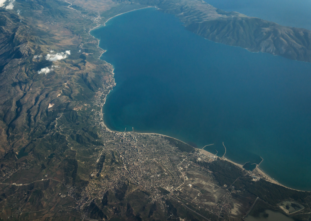
Vlorë Air Base
- Location: Vlorë, Albania
- Airport codes: No IATA code, LAVL (ICAO)
- Threatened by: 1 metre or more of sea-level rise
Albania’s Vlorë Air Base is located on the country’s coast along the Adriatic Sea. It will be flooded with 1 metre of sea-level rise. The airbase is used by the Albanian Air Force. Albania’s Adriatic coast is already experiencing coastal erosion due to sea-level rise.

Maiwikipedia // Wikimedia Commons
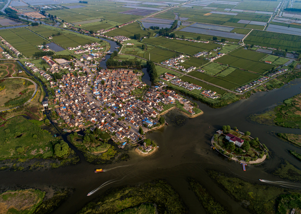
Wenzhou Yongqiang Airport
- Location: Wenzhou, China
- Airport codes: WNZ (IATA), ZSWZ (ICAO)
- Threatened by: 0.5 metre or more of sea-level rise
China’s Wenzhou Longwan (WNZ) Airport will find itself flooded from the East China Sea with a 0.5 metre or more of sea-level rise. The airport serves the city of Wenzhou, which has more than 3.5 million residents. It operates flights to a number of destinations including Beijing and Shenzhen.
He jinghua // Shutterstock
Yancheng Airport
- Location: Yancheng, China
- Airport codes: YNZ (IATA), ZSYN (ICAO)
- Threatened by: 0.5 metre or more of sea-level rise
Located north of Shanghai, China’s Yancheng airport (YNZ) will be underwater with a 0.5 metre or more of sea-level rise. Its location along the Yellow Sea makes it vulnerable to changes in sea level. Almost 100 flights take off and land at the airport, serving China as well as five other countries.
Maeshima hiroki // Wikimedia Commons
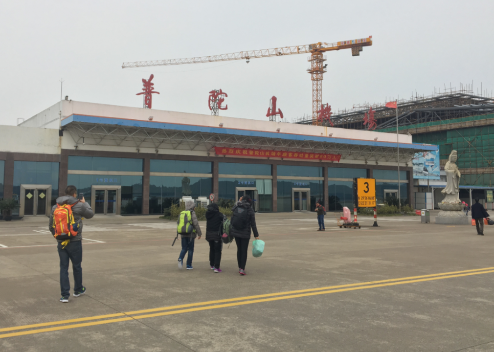
Zhoushan Airport
- Location: Zhoushan, China
- Airport codes: HSN (IATA), ZSZS (ICAO)
- Threatened by: 1 metre or more of sea-level rise
The Zhoushan Airport, also in China, is situated on Zhujiajian Island in the East China Sea and will be flooded by 1 metre or more of sea-level rise. It flies regionally to other parts of China, including Beijing and Shanghai. The airport has an international terminal that is not yet in operation.
