Updated at 6:14 a.m.
Since writing this story, the magnitude has been downgraded to 4.1.
This adjusting is typical after such events.
—Original story—
Yes, that was another earthquake at 5:02 a.m. this morning.
Emergency BC says there is no tsunami threat.
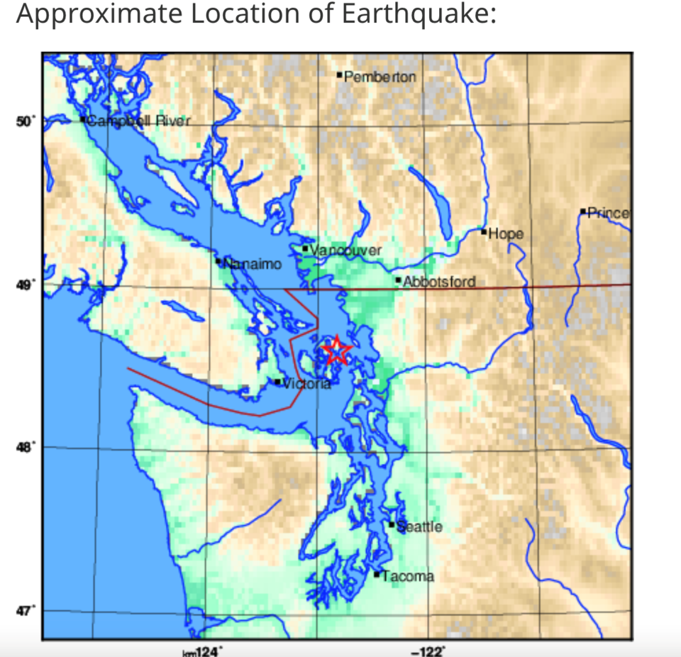
There was a 4.8 magnitude quake between Washington State and Vancouver, according to Natural Resources Canada.
The epicentre of this morning's quake was 45 kilometres east-northeast of Victoria and 73 km south-southeast of Vancouver.
Initial information from Natural Resources Canada is that it was 20 km deep,
No damage has been reported.
It was lightly felt in around Victoria and Vancouver, and in Squamish where it felt like an extended shiver.
If you felt it, you can fill out this report.
Why didn't we get an alert?
We didn't get an alert on our phones this morning about the earthquake because it was not severe enough to warrent it.
That is what the government organization, PrepareBC said on X.
"The Earthquake Early Warning system did not issue a public alert for this event because the magnitude & intensity were below thresholds at which harm might be expected," reads the post that came after the earthquake hit.
"The EEW system only alerts for potentially harmful shaking levels. Earthquakes generating only low levels of shaking will not produce EEW alerts."
Find out more about the EEW system on the Earthquakes Canada site.
Did you know?
-
The Natural Resources Canada site explains that magnitude is a measure of the amount of energy released during an earthquake.
-
On average, the Geological Survey of Canada (GSC) records and locates over 4,000 earthquakes in Canada each year.
- The province in Canada least likely to experience an earthquake is Manitoba.
- The province in Canada most likely to experience an earthquake is British Columbia.
-
Scientists at the Geological Survey of Canada office near Sidney, B.C. record and locate approximately 1,000 earthquakes each year in western Canada.
- The largest earthquake recorded (during historic times) in Canada was a magnitude 8.1 event that struck just off the Haida Gwaii on Canada's west coast on August 22, 1949.
Find many more facts like this on the Natural Resources site.
*Please note, this story is being updated as new information becomes available.


